Research in Hydrogeology

Research in hydrogeology in the Department of Geological Sciences broadly includes field-based studies and mathematical modeling of ground-water flow, mass transport, and reactions in the subsurface. Past and present research topics include: 

Controls on ground-water composition in regional sedimentary aquifers
Bengal Basin: An estimated 50 million residents of the Bengal basin in eastern India and Bangladesh face health risks from ingesting arsenic in shallow ground water. The arsenic appears to be released from sediments transported down the valleys of the Ganges and other rivers draining the Himalayas; land-use practices may accelerate the rate of arsenic release. Abhijit Mukherjee (PhD candidate) is studying the quality and sustainability of deep ground water in the Indian state of West Bengal. We are using data from the network of water-supply wells operated by the state Public Health Engineering Directorate to develop models of ground-water flow and chemical evolution at the regional scale. Interim results indicate that some deep public wells are contaminated with arsenic. High iron and low dissolved oxygen concentrations are consistent with results of studies in Bangladesh; arsenic appears to be liberated as iron oxides dissolve under anoxic conditions. Inferring ground-water flow paths and accompanying trends in water quality is complicated because of the heterogeneous delta-plain sediments and extensive pumpage for irrigation.

High Plains (Ogallala) Aquifer: The High Plains aquifer is the largest aquifer in the USA and an important resource for agricultural, industrial, and municipal uses. Ground-water withdrawals have caused the water table to fall as much as 1 meter per year in some areas since the 1950s. Consequently, numerous studies of recharge have been conducted, but relatively few studies have examined controls on water quality in this semi-arid region. Potential water-quality problems include nitrate contamination and salinization by brines from underlying rocks. Sunil Mehta (PhD 2000) documented that areas of salinization northeast of Amarillo, Texas, result mainly from upward seepage of relatively shallow brines into the High Plains aquifer and not leakage of deeper brines produced with oil and gas. Detailed mapping of water quality in pilot borings can guide the placement of wells and thus limit the impact of brine seepage in municipal wellfields. Elsewhere in the region, the composition of ground water in the High Plains aquifer is controlled primarily by processes occurring during recharge, including depression-focused infiltration, evapotranspiration, carbon cycling in the vadose zone, and (probably to a lesser extent) silicate weathering and cation exchange. Denitrification in the soil zone limits nitrate loading to ground water and thus facilitates the use of waste water for artificial recharge, which promotes water conservation.

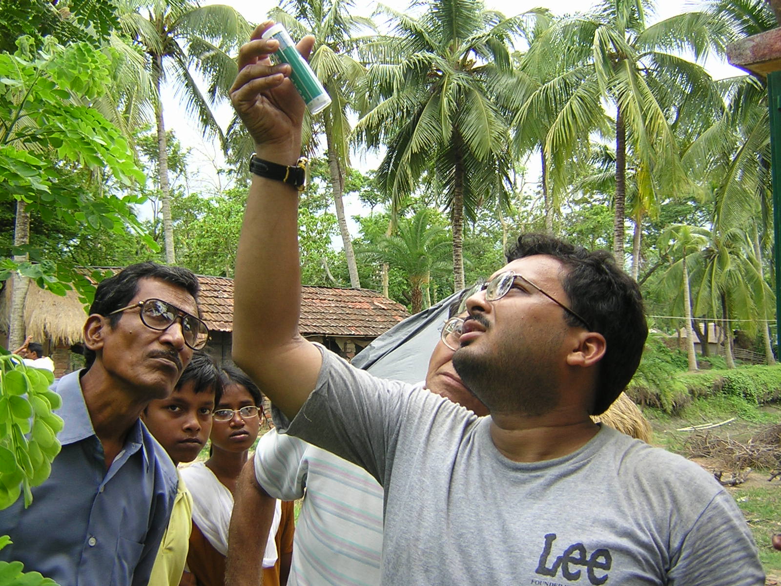
(Left: Abhijit Mukherjee uses a colorimetric technique to measure the concentration of ferrous iron in the Canning public-supply well, June 2005.
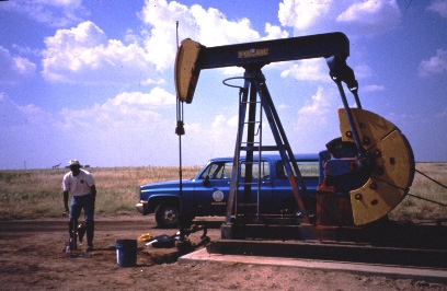
Right: Sunil Mehta collects brine from an oil well in Carson County, Texas, August 1997.) 

Sediment and pathogen transport in Inner Bluegrass karst ground-water basins 
Ground-water flow along bedding planes and fractures in limestone results in dissolution of the rock, evolution of conduits, and development of an integrated surface and subsurface drainage network. Because of the size of these conduits, particle transport is much more significant in karst than in other types of aquifers. The transport of pathogens (such as bacteria and viruses) can be facilitated by sorption to fine sediment mobilized during storms. With colleagues in Agronomy, Civil Engineering, and the Kentucky Geological Survey, Todd McFarland (MS 2003), Tom Reed (MS student), and James Ward (PhD student) have monitored two springs in Woodford County, Kentucky, for discharge, water chemistry, pathogen concentrations, and sediment characteristics during both base flow and storm flow. Blue Hole spring in the city of Versailles drains a mixed urban and agricultural basin, whereas spring SP-2 at the UK Animal Research Center drains an agricultural basin. Microbial results are consistent with differences in land use. Suspended sediment consists mainly of silt-sized detrital quartz, and Blue Hole spring appears to respond more rapidly to precipitation than SP-2 does.

(Blue Hole spring, May 2002.)

Ground-water/surface-water interactions in the Gulf Coastal Plain of western Kentucky
Paducah Gaseous Diffusion Plant (PGDP): Researchers and regulators are emphasizing the need to view water and chemical fluxes within an integrated (watershed) framework, rather than decoupling studies of subsurface and surface processes. We hypothesized that contaminant plumes from the U.S. Department of Energy's Paducah Gaseous Diffusion Plant (PGDP), a Superfund site in western Kentucky, could discharge to wetlands and streams in the Ohio River flood plain. Contaminants of concern include trichloroethene (TCE) and technetium-99, a radionuclide associated with uranium reprocessing. Eric Wallin (MS 1998), Abhijit Mukherjee (MS 2003), and Danita LaSage (PhD 2004) quantified spatial and temporal variability in seepage along Bayou and Little Bayou Creeks, which bracket PGDP. We located contaminated springs along Little Bayou Creek and documented that discharge to tributaries can short-circuit plume migration to (and dilution by) rivers. Spring-flow rates and contaminant concentrations in the stream tend to decrease from May through January, then rebound. Josh Sexton (MS student) is developing a GIS-based stratigraphic framework model of the study area.

Ledbetter Creek: With colleagues at Murray State's Center for Reservoir Research, Karen Thompson (MS 2002) and Todd Aseltyne (PhD candidate) have monitored and modeled the influence of reservoir-level manipulation on ground-water flow within the Ledbetter Creek watershed in Calloway County, Kentucky. Ledbetter Creek is a tributary to Kentucky Lake, the terminal reservoir on the Tennessee River. Water-level monitoring of piezometers and wells and gaging of stream and spring flow indicates that ground water discharges to Ledbetter Creek and within the creek's embayment. As at PGDP, discharge rates and water levels in wells tend to be highest in late spring and lowest in early winter. Within the embayment itself, the hydraulic gradient is reversed from upward to downward when the embayment is submerged between April and September.
 

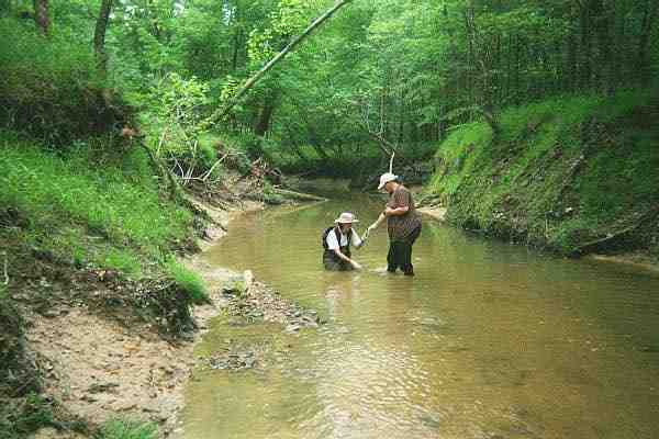
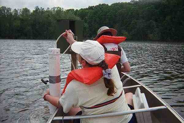
(Left: Andrea Hougham [undergraduate assistant] and Danita LaSage collect samples from a sand boil [submerged spring] in Little Bayou Creek, May 2000.
Right: Danita and Andrea monitor water levels in piezometers in Ledbetter embayment, May 2000.)

Natural attenuation of trichloroethene in ground water and surface water
Monitored natural attenuation can be a practical, cost-effective option for remediating ground-water contamination, particularly for chlorinated hydrocarbons such as TCE, a common solvent and suspected carcinogen. Ground-water remediation at PGDP focuses on zones of the Regional Gravel Aquifer (RGA) with TCE concentrations > 1 mg/L. Although TCE does not undergo significant natural attenuation within the RGA, processes in overlying or underlying strata might limit TCE impacts on surface-water ecosystems or deeper ground-water flow systems. David Butler (MS 1999) and Nadege Etienne (MS [Plant and Soil Science] 1999) identified methanogenic bacteria, which have been shown to be capable of degrading TCE at other sites, in soils and sediments like those bounding the RGA. However, biodegradation was insignificant in batch cultures over periods as long as 10 months, perhaps because of a lack of nutrients or a lack of acclimation to TCE. Chris Sweat (MS 2000) found that TCE sorption to soils and sediments appears to depend upon both the amount and the polarity of organic matter. Using tracer tests, Abhijit Mukherjee (MS 2003) found that dilution and volatilization appear to limit TCE concentrations in Little Bayou Creek.

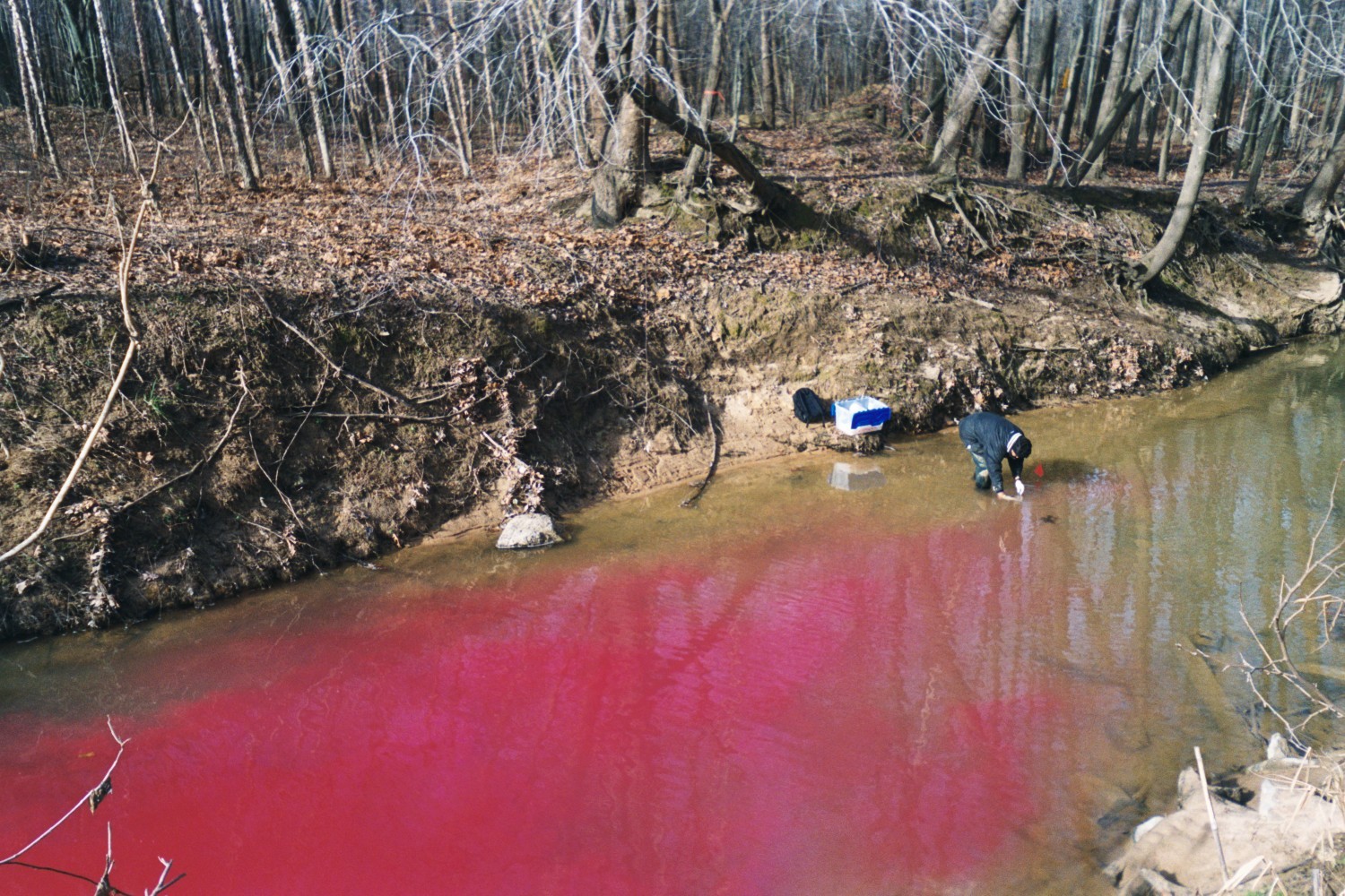
(Abhijit Mukherjee collects samples during Little Bayou Creek tracer test, January 2002.)


Return to Fryar home page
Return to UK Geological Sciences home page