Through a variety of resources, the Kentucky Geological Survey is attempting to help students better understand the place where they live and to learn to KnowKentucky. In an effort to reach out to teachers across the state, KGS has launched a Maps-to-Teachers publication series. Teachers may request copies of maps for a nominal charge, posters, PowerPoints, reports, and other resources for their classrooms by KGS
The poster GIS in Kentucky illustrates the use of geographic information systems in mapping Kentucky. Generalized Geologic County Maps are now available for all Kentucky counties, complemented by a PowerPoint Maps Tell Us About Where We Live. The poster Kentucky Landscapes Through Geologic Time shows how the sedimentary rocks that are the foundation of Kentucky were formed when Kentucky lay beneath equatorial seas hundreds of millions of years ago. Geologic Hazards in Kentucky shows the type and extent of geologic hazards in the state. Kentucky Terrain shows the regions of Kentucky. River Basin Maps, large-scale maps of the 7 major Kentucky river basins, help students better understand our water resources and the need to protect them. The purpose of all the resources is to help students and the general public better understand the geology of the place where they live and how the rocks that form the land may affect human activities. All maps are illustrated with photos and diagrams, and supplemented with text to explain geologic issues.
A Brief History of Earth, 100-slide PowerPoint,may also be downloaded here:
https://kgs.uky.edu/kgsweb/download/geology/EARTHHISTORY.ZIP
More map and PowerPoint resources will be added from time to time, check back.
Additional earth science resources are available at www.uky.edu/KGS/education/index.htm
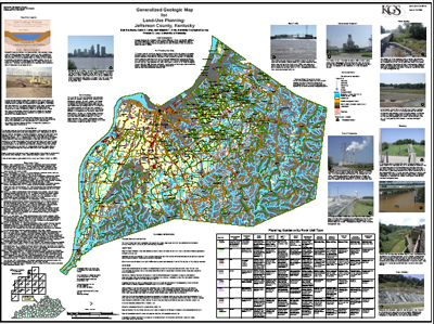
A sample of the land-use planning maps available from KGS |
"Thank you so much for sending my class the geology map for Fayette County. I have it prominently displayed in the classroom and my students started using it as soon as I hung it up to find sinkholes near their homes. The resource that you have provided will greatly enhance my instruction by clearly illustrating to my students the importance of earth science in their daily lives. Also, thank you for the web site links!" "On behalf of our entire Science Department, I want to thank you for the beautiful map of Mason County. It is full of terrific learning opportunities for our kids." "Thank you so much for the map of Lexington! My students and I are currently studying History of Earth based on sedimentary rock! This will be very helpful!" "Thank you so much for sending the maps of Allen County. They are very neat. I shared one of mine with the social studies teacher. However, when one of the other S.S. teachers saw them she really wanted one. If you are capable of sending another set that would be great! Once again thank you for sending such a wonderful resource to us at no cost!" "I recently received the Floyd county map and it is wonderful. In fact it is so nice that the social studies teachers in my building and the rest of the science department asked it they could each get one. That is a total of 7 teachers. Just checking if it would be possible to get some more of those? Have a great day and great job on the map." |