Thousands of records on Kentucky minerals and mining are now available at the website of the Kentucky Geological Survey at the University of Kentucky. During the past decade, KGS staff Warren Anderson, Tom Sparks, and Richard Smath have developed a minerals database of scanned documents, including core logs, cross sections, mine and property maps, geochemical and geophysical maps, chemical analyses, and unpublished reports. This map service provides information and location data pertaining to Kentucky's ore mineral resources and their associated commodities: fluorite (fluorspar), galena (lead), sphalerite (zinc), barite, iron, nitrates, and phosphates.
Sparks built the original version of the spatial database, and Doug Curl, who heads the Survey’s Geologic Information Management Section, developed the final online map service that displays the locations from which the data were drawn. The database provides access to more than 20,000 files containing information about ore-bearing mines and their associated minerals in the state, particularly in the three major mineral districts in central, southern, and western Kentucky. Any core data with significant mineral information were also included in this database, especially if they came from the mineral districts.
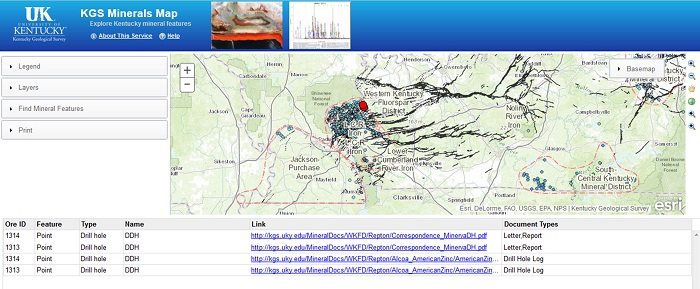
"With the recent opening of a new fluorite mine and additional fluorite exploration drilling in western Kentucky, this information should be very valuable to the mining community," says Anderson. The database is available online at http://kgs.uky.edu/kgsmap/KGSMineral/. The document files are organized by links to mine names in western Kentucky, and by county names in central and southern Kentucky. Spatial and tabular information about a mine or mineral site is available, and scanned images are also available.
A link called "About This Service" describes the map service and gives instructions on how to use the service. Panels on the left side of the page include a legend describing icons on the map, layers that can be turned on and off, along with search and print utilities. Information can be searched by name (general to specific), commodity, mineral, or location (county or quadrangle).
This database was made possible by the contributions of records from geologists, mining and exploration companies, and researchers, as well as students and staff who scanned and organized these records over the years of the database’s development.