
The Kentucky Geological Survey has archived this material, meaning (1) it is for reference, research, or recordkeeping; (2) it was created before April 24, 2026; (3) and the material has not been changed or altered since being archived. Please refer to our KGS Accessibility page for more information.
KGS Home > Geology of Kentucky
Bluegrass Region![]()
 |
 |
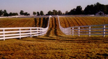
Although Kentucky is called the Blue Grass State, the Bluegrass physiographic region (shown in green) is restricted to the central part of the State where Ordovician (and some Silurian, and Devonian) age rocks are exposed at the surface. The Inner Blue Grass (shown in light green on the map) is characterized by gently rolling hills and rich, fertile soils, which are perfect for raising horses (see photo). The gently rolling hills are caused by the weathering of relatively thick-bedded limestone that characterize the Ordovician strata of central Kentucky that has been pushed up along the crest of the Cincinnati Arch.
 |
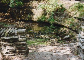 |
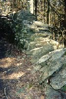
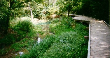
Weathering of the limestones produces sink holes, sinking streams, springs, caves and soils. The soils are fertile because the Ordovician limestones contain phosphate minerals (e.g., apatite), which are natural fertilizers. The Kentucky River Palisades are cliffs in the gorge or canyon along the Kentucky River where it cuts through resistant massive limestones and dolostones (High Bridge Group). These massive limestones and dolostones are the oldest strata exposed at the surface in Kentucky.
The Outer Bluegrass (dark green on the map) is characterized by deeper valleys, with little flat land, because the bedrock in this area is mostly composed of interbedded Ordovician limestones and shales that are more easily eroded than the limestones of the Inner Bluegrass.