
KGS Home > Geology of Kentucky
Strata of Silurian Age
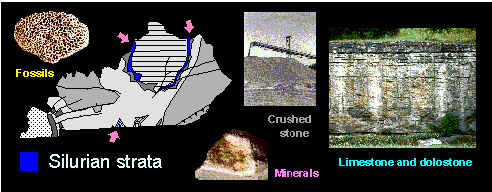
On the geologic map of Kentucky, Ordovician rocks are surrounded by a ring of Silurian strata (440 to 410 million years ago), shown in red. The area where these rocks crop out is known as the Knobs Region. Silurian strata consists mostly of limestones and dolostones. Where these rocks dip beneath the surface in the Big Sinking-Irvine area of eastern Kentucky, they are very porous and form natural reservoirs for oil.
On the geologic map, one can see that the Silurian rocks do not completely circle the Ordovician strata, but rather pinch out to the south in Boyle, Casey, Lincoln, and Montgomery Counties. Where the Silurian rocks are missing, Devonian rocks lie directly on top of Ordovician rocks. This is called an unconformity. An unconformity means that a large segment of geologic time is missing from the rock record, just as if someone had torn the pages out of a book.
Other related topics of interest: