KGS Home > Geologic Hazards
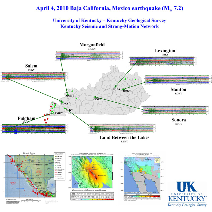
Magnitude 7.2 Baja California, Mexico earthquake on April 4, 2010
A Mw 7.2 earthquake occurred at 3:40PM PDT on Sunday, April 4th, 2010, located near the Laguna Salada fault in northern Baja California in Norte (NTE) B.C., Mexico. The fault rupture appears to trend southeast-northwest on the Laguna Salada fault, with the epicenter locate at 32 deg. 7.7 min. N (32.128N), 115 deg. 18.2 min. W (115.303W). The earthquake occurred approximately 40 miles south of the Mexico-USA border at a depth of 10 km along the principal plate boundary between the North American and Pacific plates. This is an area with a high level of historical seismicity, and also it has recently been seismically active, though this is the largest event to strike in this area since 1892.
For more information please visit the following websites:
https://earthquake.usgs.gov/earthquakes/recenteqsww/Quakes/ci14607652.php
https://www.scsn.org/
https://www.cisn.org/
The earthquake was recorded on instruments in the Kentucky Seismic and Strong-Motion Network, operated jointly by the Kentucky Geological Survey and the Department of Earth and Environmental Sciences at the University of Kentucky.
The graphic below is the actual record of the earthquake made by 7 Network instruments.