The Kentucky Geological Survey has archived this material, meaning (1) it is for reference, research, or recordkeeping; (2) it was created before April 24, 2026; (3) and the material has not been changed or altered since being archived. Please refer to our KGS Accessibility page for more information.
KGS Home > Geologic Hazards
Magnitude 3.7 earthquake southeast Missouri, March 2, 2010
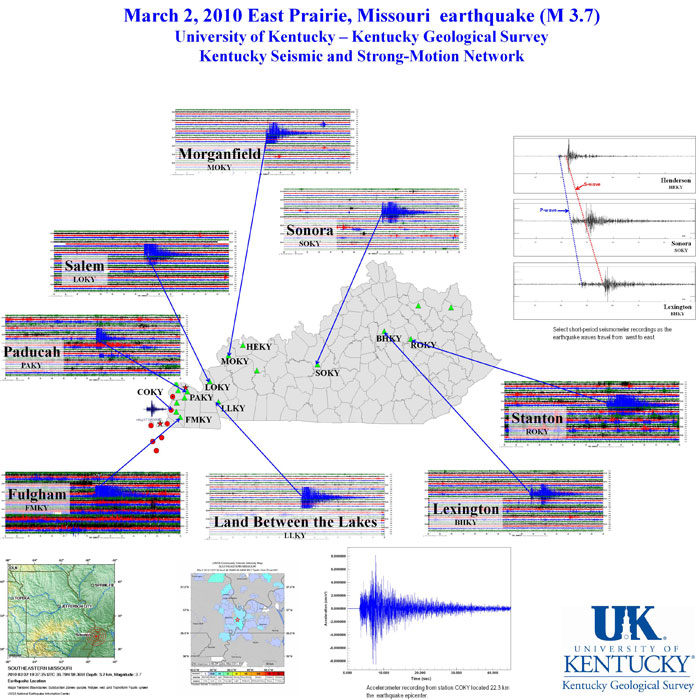
A minor earthquake occurred Tuesday, March 02, 2010 at 02:37:35 PM (EST) near East Prairie, Missouri. The magnitude (mb,Lg) 3.7 earthquake occurred 8.2 kilometers (5.0 miles) underground.
For more information on this event, see this USGS website: https://earthquake.usgs.gov/earthquakes/recenteqsus/Quakes/nm1937.php
The earthquake was recorded on instruments in the Kentucky Seismic and Strong-Motion Network, operated jointly by the Kentucky Geological Survey and the Department of Earth and Environmental Sciences at the University of Kentucky.
The graphic below provides information about the earthquake as recorded by the Network.