
The Kentucky Geological Survey has archived this material, meaning (1) it is for reference, research, or recordkeeping; (2) it was created before April 24, 2026; (3) and the material has not been changed or altered since being archived. Please refer to our KGS Accessibility page for more information.
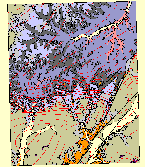
This is the final version of the Hustonville digital 7.5-minute geologic quadrangle map, Lincoln and Casey counties, in Central Kentucky. Two coverages are overlain to make up the data for this map -- a structure coverage and a formation coverage. The structure coverage contains the original structure lines that are mapped on top of the Calloway Creek Limestone and all of the faults. The formation coverage has polygon topology and is labeled according to present-day interpretations and nomenclature.
There are no legends or labels on this image which emphasizes that the purpose of our project is not to simply make maps. The purpose is to capture the mapped data digitally, so they can be used in a geographic information system for analysis. Any data that are normally associated with a legend or with labels are stored in the attribute table of the appropriate coverage. Maps can be made either from these data, or as a derivative of an analysis of these data.
All the quadrangles are being digitized in the UTM (universal transverse Mercator) projection system. This is the reason for the slight rotation in the quadrangle above. The Digital Geologic Mapping group uses UTM because it provides maximum efficiency and flexibility, while allowing for compatibility with many other USGS products.