A clickable map!!
location of this map in Fayette County, Kentucky
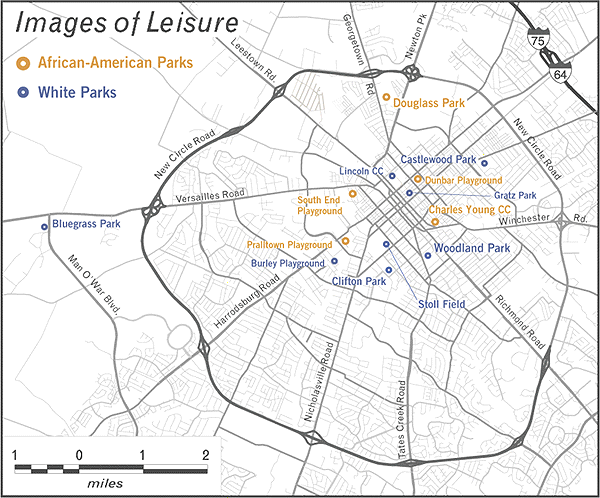
Please click a park to visit its photographic gallery
|
This map represents the locations of many early parks in Lexington’s segregated park system. All parks indicated on this map were established prior to 1935, with the majority opening before 1920. In 1998, the only parks that have not survived are Bluegrass Park (today, an Airport); Stoll Field (consumed by the University of Kentucky); Clifton Park (also consumed by UK and in 1998 became the grounds of UK’s main library); and Lincoln Community Center (today, a public school). Although more parks existed in Lexington than is here shown, these locations were photographed, preserved, and have since migrated to this website. Obviously, countless citizens of Lexington, and beyond, nurture many more images that have yet to experience the color space of the internet, or the comfortable darkness of a public archive. To them, this site yearns for your awareness of public preservation. |
now by all means, go visit a park!!