
If you’ve wanted to find some of Kentucky’s arches and natural bridges, a new KGS web page and interactive map provide help locating dozens of them, along with information about and photos of these natural wonders. Steve Martin, of the KGS Geologic Mapping Section, has been studying Kentucky’s arches and natural bridges for five years, taking measurements, collecting data on fracture orientations and joints, and archiving photos. With help from Liz Adams, of the Geoscience Information Management Section, the new web page makes much of his documentation publicly available.
'"I wanted to create an online system where the public and arch hunters could access arch location data," Martin says. "So, the page we have now focuses on doing just that."
Forty arches are shown on the website, available at kgs.uky.edu/arches. Clicking on an arch location on the map will bring up information for the feature, including its name and type, the county where it’s located, size, and other information. Several photos of each arch or bridge are also available, linked from the KGS photo database. "These are arches that are on public lands, such as state parks, national forests, and national recreation areas, and they all have easy access, Martin says. "Each location has a trail leading to the arch, so people don’t need to get off a trail to find it.
"Arches are more common than people think in this part of the country, although I don’t think a lot of people know they exist here, Adams says. "We wanted to educate people about them and share their beauty with as many people as we can through the Web. Users can simply click on the mapped arch icons to learn more about them and explore the pictures. For more information, they can click on "Detailed Image Info or the image itself for an enlarged view. Navigation between available images and arches is accomplished by arrows icons at the top of each pop-up window.
Those who are more familiar with the state’s arches can search a list of arches visible in the current map view under the "Arches tab. Users can select a desired arch and click on "Zoom To to go to that specific feature. This list is a live data set, and will update every time a user zooms in or out on the map. A collection of different base maps for the service also allows users to choose the base map that fits their needs.
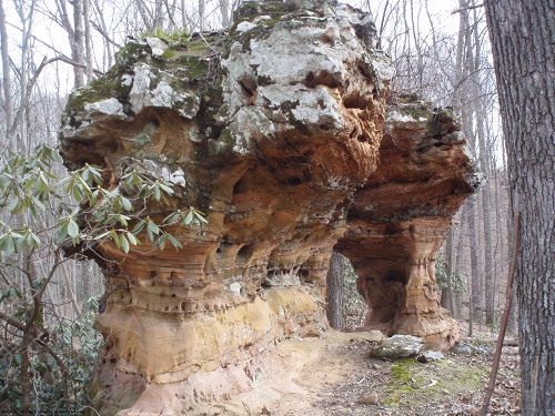
Devil’s Market Arch in Menifee County is one of the 40 arches featured on the new page.
:
The arches page is linked under the KGS map services.