Contact: Dave Harris
The most commonly cited geologic model for hydrothermal dolostone reservoirs in the Appalachian Basin is Columbia Natural Resources' model for the Gloades Corners Road Field in Steuben County, New York (below). This illustration was prepared for CNR's well-spacing application to the State of New York Department of Environmental Conservation. The following web pages may also be of interest:
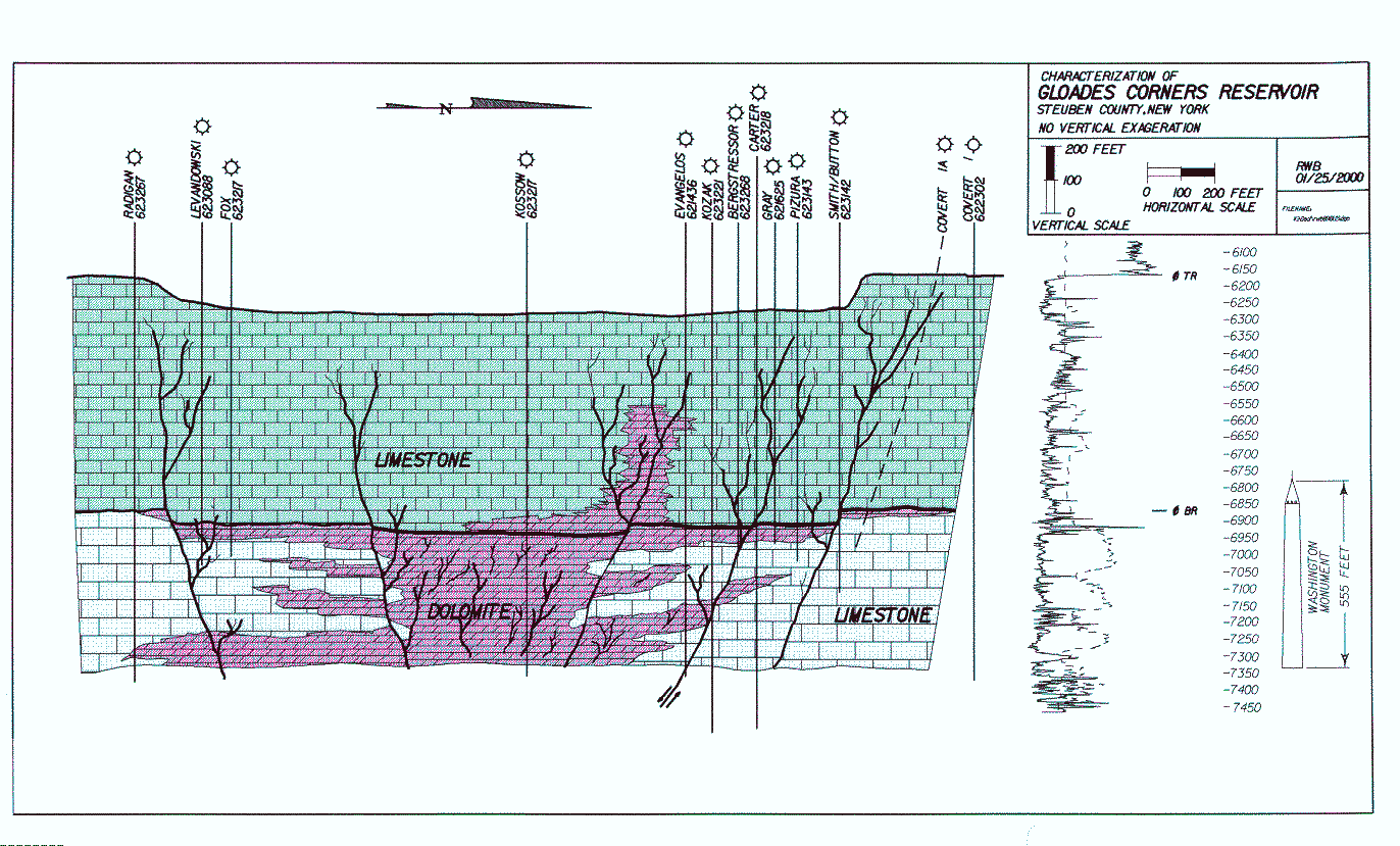
Glodes Corners Road Field spacing hearingThis model illustrates a structural graben bounded by normal or wrench faults. Magnesium-rich fluids moved along faults and fractures through the Trenton and Black River interval, dolomitizing adjacent limestone. This dolomitization process replaced calcite with dolomite, resulting in additional porosity, both from the smaller molar volume of dolomite vs. calcite, and dissolution of fossil grains. Natural gas later filled this porous dolostone reservoir, trapped by the bounding nonporous limestone.
Geologic factors controlling dolomitization are poorly understood. Trenton-Black River dolostone reservoirs are primarily located using geophysical techniques (seismic-reflection data), but there are several geological problems in predicting reservoirs. First, the timing of limestone replacement by dolostone is important in determining the relationship between porosity development and gas migration. Second, the control on dolomitization by depositional facies is unknown. Knowing whether dolomitization replaced specific facies allows predictive models to be developed, based on depositional trends. Third, structural controls on hydrothermal fluid movement are of interest, since not all faults are dolomitized. Determining which faults were prone to dolomitization will allow prediction of favorable structural fairways. Finally, interpreting the source of dolomitizing fluids and migration pathways will help to define the geographic limits of the play.