
The Kentucky Geological Survey has archived this material, meaning (1) it is for reference, research, or recordkeeping; (2) it was created before April 24, 2026; (3) and the material has not been changed or altered since being archived. Please refer to our KGS Accessibility page for more information.
KGS Home > Geology of Kentucky
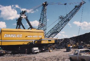
The Western Kentucky Coal Field![]()
The outcrop of Pennsylvanian strata, shown on the geologic map, defines the limits of the Eastern and Western Kentucky Coal Fields (shown in gray on the physiographic map). The Western Kentucky Coal Field is smaller than its eastern counterpart. It comprises the southern edge of a larger geologic feature called the Illinois or Eastern Interior Basin, which includes the coal fields in Indiana and Illinois.
 |
 |
As in eastern Kentucky, the border of the Western Kentucky Coal Field and the Mississippi Plateau is commonly marked by an escarpment because thick Pennsylvanian-age sandstones are resistant to erosion. However, because this coal field is not adjacent to the Appalachian Mountains, and the sandstones are less continuous, the escarpment is not as dramatic as along the Cumberland Escarpment of the Eastern Kentucky Coal Field. Pennyroyal State Park (pictured above) is located along the southern edge of the escarpment.