KGS Home > Geologic Hazards
Greenbrier, Arkansas earthquake swarm. February 28, 2011
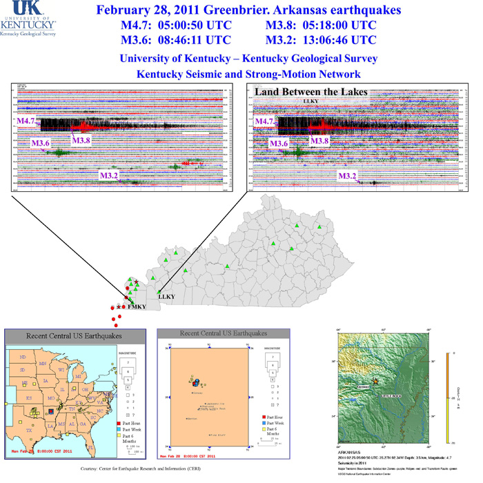
The Kentucky Seismic and Strong-Motion Network recorded several earthquakes occurring Monday, February 28, 2011 near Greenbrier, Arkansas. A sampling of the recorded earthquakes are shown in the graphic below and range in magnitude from M3.2 to M4.7 and at from 2.6 km to 5.0 km (1.6 miles to 3.1 miles). For more information on these events, see these websites:
Click on the underlined portion of an earthquake record in the list below for more information.
MAG |
UTC DATE-TIME |
LAT |
LON |
DEPTH |
LOCATION |
3.2 |
35.285 |
-92.394 |
5.0 |
4 km ( 3 mi) SE of Twin Groves, AR |
|
3.6 |
35.282 |
-92.340 |
2.6 |
5 km ( 3 mi) S of Guy, AR |
|
3.8 |
35.270 |
-92.374 |
4.2 |
5 km ( 3 mi) NNE of Greenbrier, AR |
|
4.7 |
35.265 |
-92.344 |
3.8 |
6 km ( 4 mi) NE of Greenbrier, AR |
The earthquakes were recorded by the Kentucky Seismic and Strong-Motion Network, operated jointly by the Kentucky Geological Survey and the Department of Earth and Environmental Sciences at the University of Kentucky.
Click the link below the graphic to download.