
The Kentucky Geological Survey has archived this material, meaning (1) it is for reference, research, or recordkeeping; (2) it was created before April 24, 2026; (3) and the material has not been changed or altered since being archived. Please refer to our KGS Accessibility page for more information.
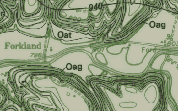
This image represents part of a 7.5-minute geologic quadrangle map produced on Mylar, which was used as part of the printing process by the U.S. Geological Survey. The Mylar maps contain all of the geologic information plotted on a topographic base. In this image, the geologic information is shown as black lines, and the topographic and cultural information is shown as green lines. A second set of Mylar maps is produced from these originals by removing the topographic and cultural features using a photographic enhancement technique that filters out the green lines and leaves only the black-line geologic information. The second set of Mylar maps is then used in Step 2. We are currently investigating new methods of converting these Mylar maps utilizing an image classification program.