In the area of this map, the Kentucky River is one of the main recreational features with several parks, nature preserves, and numerous trails (e.g., Buckley Wildlife Sanctuary, Raven Run Park, and several Nature Conservancy holdings, Fort Boonesborough State Park). Some of the geologic processes leading to its formation are discussed in the section below.
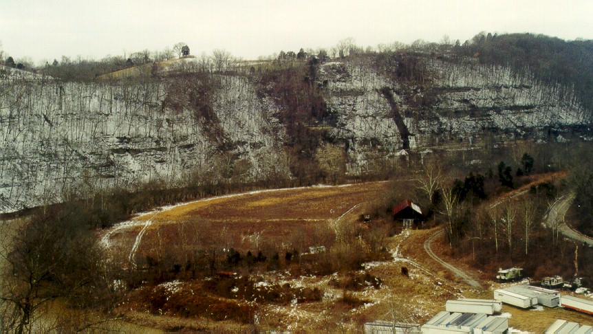
Where the Kentucky river cuts through the thick limestone and dolomite of the High Bridge Group (north of the Kentucky River and Lexington fault systems), a very scenic cliff-lined gorge known as the Kentucky River Palisades was formed. The Kentucky River Fault System appears to have affected the river in a significant way. Along the eastern side of the map, the Kentucky River flows to the northwest. Where it encounters the Kentucky River Fault System, the river changes course and flows to the southwest, parallel to the fault system. It flows in this direction for about 20 miles (as the crow flies) where it once again resumes its northwest course to the Ohio River.
MouseOver to see labels
|
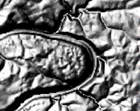
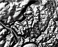
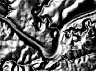
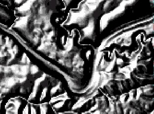
Shaded relief map of the Kentucky River in the area of Brooklyn Bridge, Wilmore 7.5-minute Quadrangle. 28 KB image.
|

|
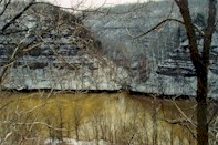
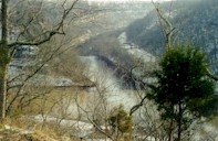
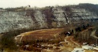
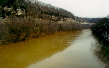
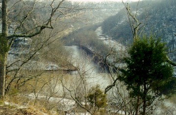
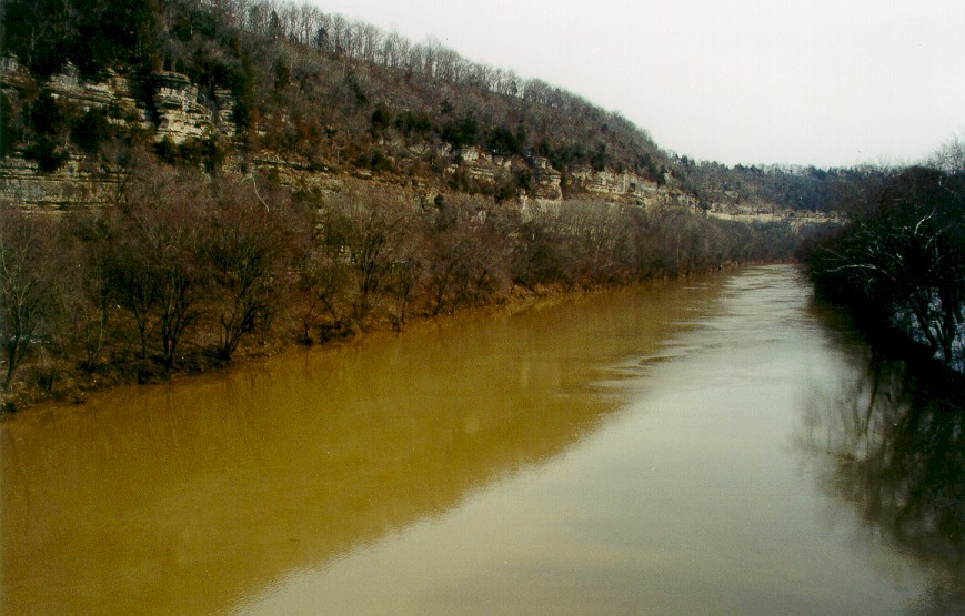
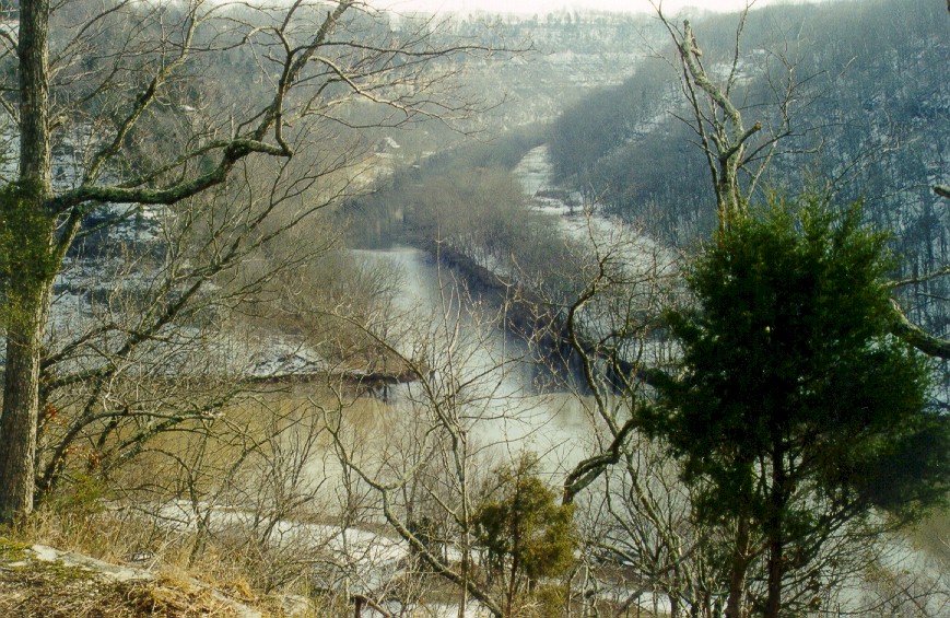
Kentucky River Palisades from Brooklyn Bridge, Highway 68, looking upstream. Wilmore 7.5-minute Quadrangle. See shaded relief map above. 22 KB image, 132 KB image.
|
|
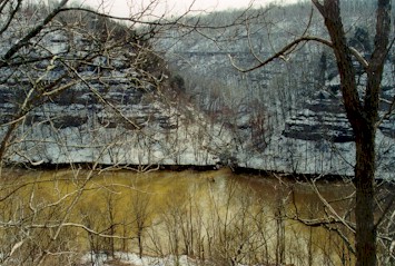
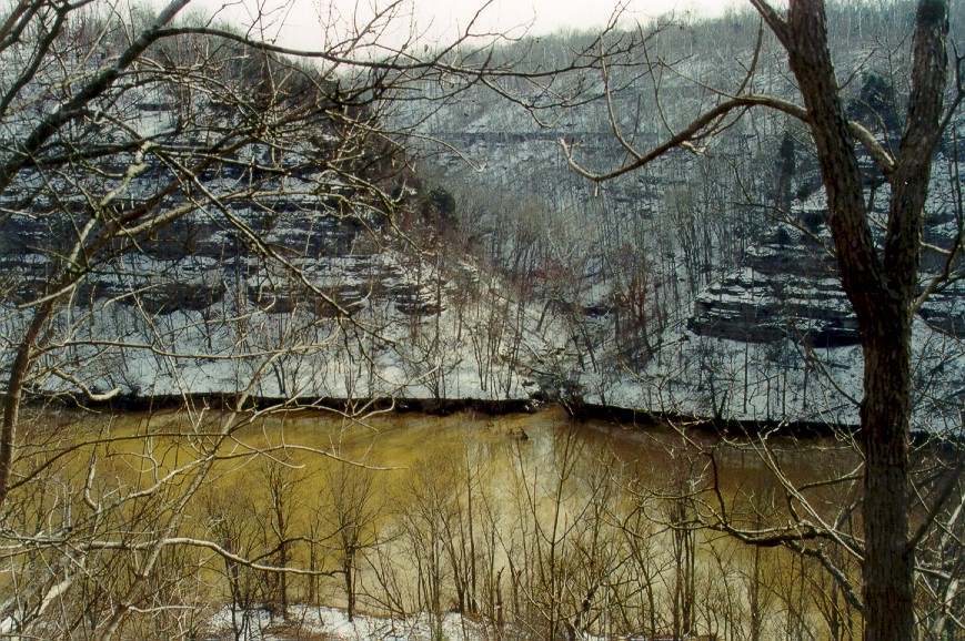
Kentucky River Palisades at confluence with unnamed creek about 7,500 feet
above Brooklyn Bridge. Wilmore 7.5-minute quadrangle. See shaded relief map above.
43 KB image,
260 KB image.
|
MouseOver to see labels
|
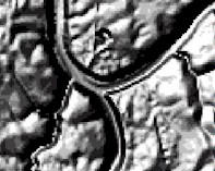
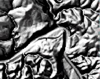
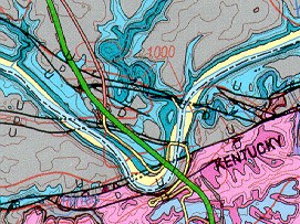
Shaded relief map of High Bridge area of Kentucky River, Wilmore 7.5-minute Quadrangle. 25 KB image.
|
|
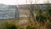
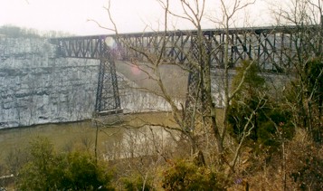
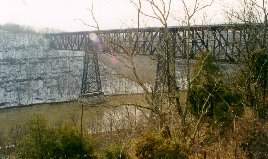
High Bridge railway bridge across the Kentucky River. Note Palisades. Wilmore
7.5-minute quadrangle. See shaded relief map above. 34 KB image,
191 KB image.
|
|
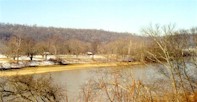
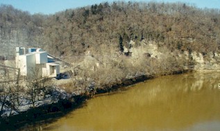
Confluence of Kentucky River (lower part of photograph) and Dix River (upper
part) from High Bridge Campground. Note Palisades. See shaded relief map above.
39 KB image,
233 KB image.
|
MouseOver to see geology
Click to see more information
|
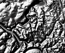
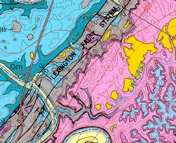
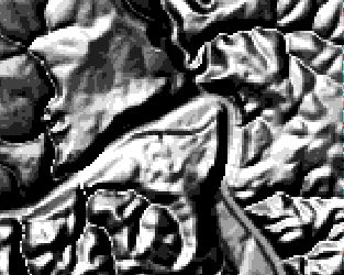
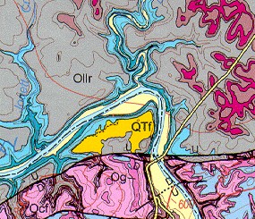
Shaded relief map of Camp Nelson area of Kentucky River, Little Hickman 7.5-minute Quadrangle. Several sinkholes can be seen in the northwestern part of the map. More information about Camp Nelson geology. 33 KB shaded relief map, 73 KB geology map image.
|
|
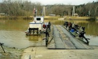
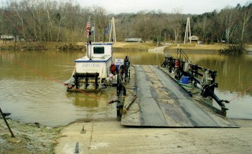
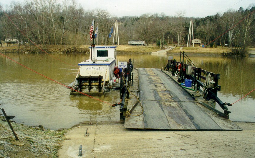
Valley View Ferry, the oldest continually-operating ferry in the state. Valley
View 7.5-minute quadrangle. 30
KB image, 177 KB image.
|
|
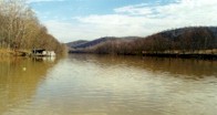
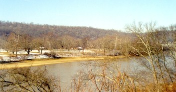
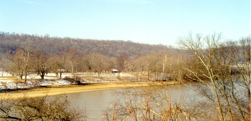
Kentucky River from Valley View Ferry, looking upstream. Note lack of Palisades
because this area is south of the Kentucky River Fault. Valley View 7.5-minute
quadrangle. 20 KB image,
120 KB image.
|
MouseOver to see geology
Click to see area of photo
|
Shaded relief map of the Clays Ferry area of the Kentucky River, Ford 7.5-minute Quadrangle. 36 KB shaded relief image, 43 KB geology map image.
|
MouseOver to see fault zone
|
The Kentucky River (difficult to see) at Clays Ferry, looking downstream
from the Clays Ferry I-75 Bridge. Note the Kentucky River Fault in the far
bank (cut bank) at the middle of the photograph. The upthrown side (with
Tyrone, Oregon and Camp Nelson formations) is on the right and Lexington
Limestone is exposed on the downthrown side to the left. Note the entrenched
meander bend, the steep cut bank and the broad floodplain on the pointbar
bank. Ford 7.5-minute quadrangle.
26 KB image,
164 KB image.
|
MouseOver to see geology
Click to see page on Boonesboro
|
Shaded relief map of Fort Boonesborough area of Kentucky River, Ford 7.5-minute quadrangle. 30 KB shaded relief image, 53 KB geology map image.
|
|
Fort Boonesborough floodplain across the Kentucky River. The original fort
was constructed just to the right of the building in the center of the
photograph. Note the lack of Palisades behind the floodplain. Note also the
first part of the Palisades at the extreme right in the photograph (behind
Memorial Bridge). Ford 7.5-minute quadrangle.
25 KB image,
142 KB image.
|

MouseOver to see fault zone
|
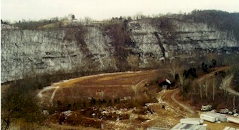
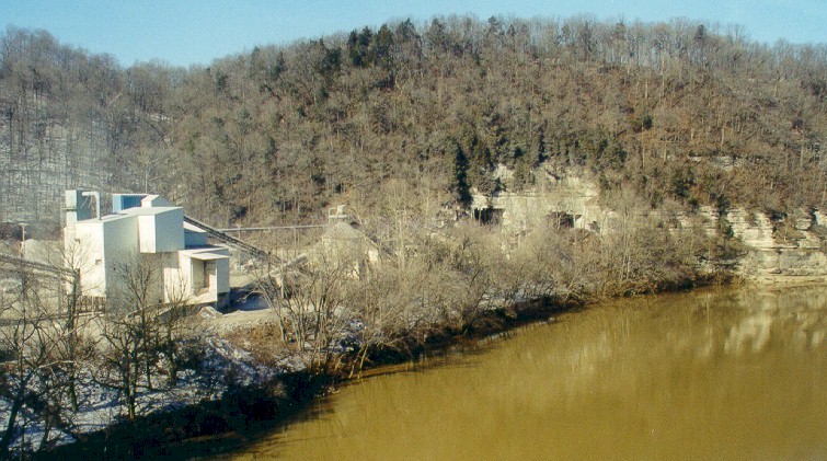
Boonesboro Quarry (The Allen Company), from Memorial Bridge, looking downstream.
Uppermost quarry face is composed of Oregon Formation, quarry is in the Camp
Nelson Limestone. The Kentucky River Fault is in the valley to the left of
the quarry face and extends to the lower right below the river level. Ford
7.5-minute quadrangle. 23
KB image, 128 KB image.
|
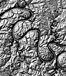 in central Kentucky is at the bottom of a deep gorge (see shaded relief map at right, part of Wilmore 7.5-minute Quadrangle). However, the meandering shape of the river is typical of rivers formed in very flat landscapes. The meandering shape of the river was formed when it was at the level of the top of the gorge (before the gorge was formed). Over geologic time, the meandering river cut down through the bedrock preserving the meander shape. This feature is called an "entrenched meander." Deposits labeled as "High-level Fluvial Deposits" (shown on the map in bright yellow) are traces of the Kentucky River when it flowed on the flat terrain above the level of the gorge, at a time before the gorge was formed. The Dix River (empounded to form Herrington Lake) has had a similar history to the Kentucky River (it also has entrenched meanders, and high-level terrace deposits).

