| Topography | ||
|
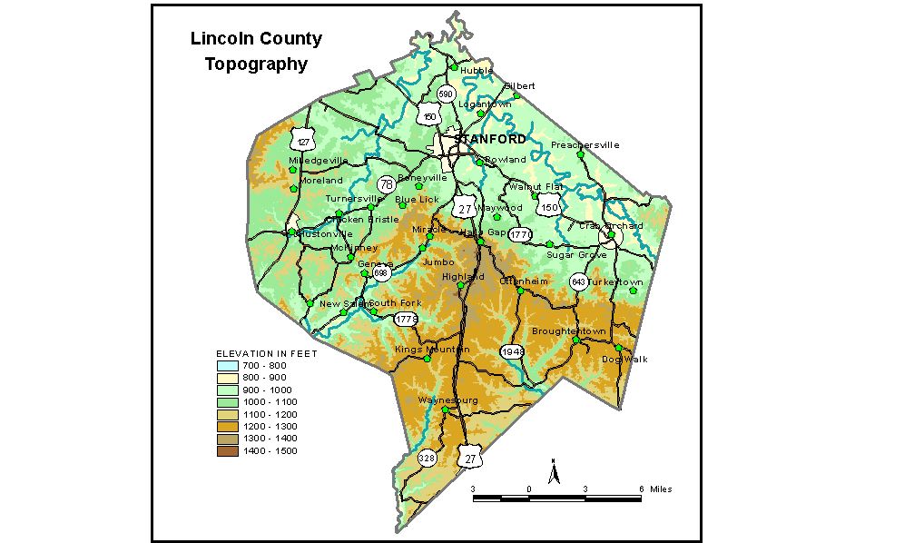
Discussion from McGrain and Currens (1978) Lincoln
County, in central Kentucky, includes portions of both the Outer
Blue Grass and Mississippian Plateaus regions. Muldraugh Hill (Highland
Rim escarpment), which crosses the county south of a line connecting
Crab Orchard, Stanford, and Hustonville, is the most conspicuous topographic
feature. A similar upland area is present northwest of Moreland in the
northwest corner of the county. This escarpment divides the Outer Bluegrass Region of northern Lincoln County from the Mississippian Plateaus
in the south. The highest elevations and the sites of greatest local relief are along
Muldraugh Hill. The highest point in the county, 1,440 feet, is a knob
adjacent to the Lincoln-Casey County line approximately 3 miles northwest
of Moreland. Elevations along the escarpment are commonly 300 feet above
the adjacent Bluegrass Region. The edge of the escarpment is highly dissected; however, to the south,
areas of flat land increase and broad tablelands are common. Elevations
decline from 1,300 feet or more on the edge of the escarpment to 1,100
to 1,200 feet in the southern part of the county. Buck and Crab Orchard
Creeks in the southeastern part of the county occupy valleys which appear
much too wide for their streams. The elevation of Stanford, the county seat, is 946 feet. Other elevations are Chicken Bristle, 921 feet; Crab Orchard, 952 feet; Halls Gap, 1,390 feet; Hustonville, 974 feet; McKinney, 1,012 feet; Moreland, 1,089 feet; and Waynesburg, 1,210 feet. The spillway elevation of Stanford Reservoir is 1,060 feet. The 7.5-minute topographic quadrangle maps that cover the county are
shown, by name and by index code (Kentucky Natural Resources and Environmental
Protection Cabinet) on the index
map. Previous--Next--Back to "Groundwater Resources in Kentucky"
|
||