Plate II
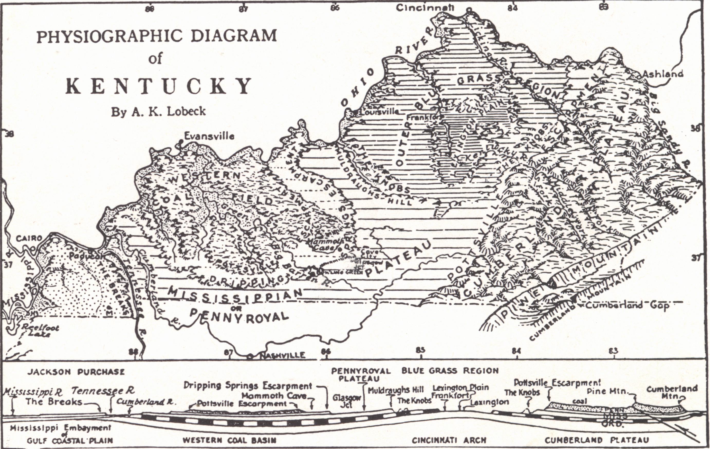
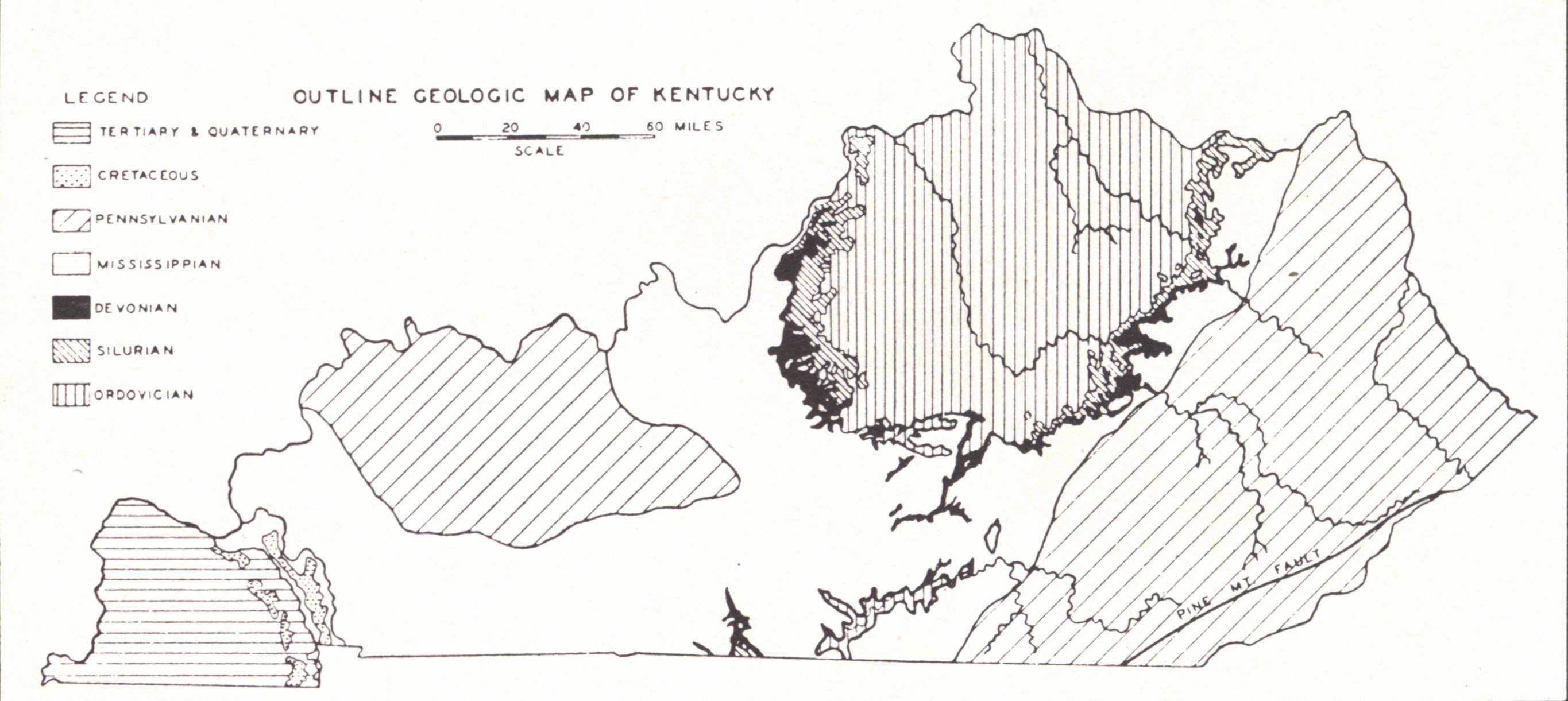
FIG. 1. Physiographic Diagram of Kentucky (Lobeck, Geographical Press, Columbia University).
FIG 2. Outline geologic map of Kentucky
The reception of Arthur M. Miller's Geology of Kentucky published by the Kentucky Geological Survey in 1919, series 5, bulletin 2, was such that the entire edition was exhausted within a few years. It has been the most-used source of information in Kentucky geological literature.
The revision of this report was begun in 1932, when for a period of two years the investigations of the Geological Survey, known at the time as the Bureau of Mineral and Topographic Survey, was under the direction of the author at the University of Kentucky. The finished work is offered with the hope that it will prove as useful as the earlier contribution.
In 1934 and 1935 the preparation of this volume was carried on with the assistance of a Works Progress Administration project, and an outline of the essentials was issued in the Progress Report of the Kentucky State Planning Board, June 1935. Similar help in drafting charts and in the compilation of the bibliography was obtained by repeated renewal of the project until August 1939. Acknowledgement is herewith made to the Works Progress Administration for the funds appropriated for this purpose. During the first part of this period Louise B. Freeman and later D. M. Young were employed for a part of their time on this project to supervise the Works Progress Administration employees. Both have been of assistance from time to time throughout the work.
To Paris Stockdale and H. R. Wanless the author is indebted for advance copies of correlation charts from Special Papers, numbers 22 and 17, of the Geological Society of America, which have subsequently appeared in print. He is similarly indebted to Louise B. Freeman for information on subsurface correlations prior to the publication of her several papers. Acknowledgement is made to E. F. Farquhar, as a member of the Haggin Fund Publication Committee, for his careful reading of the manuscript and to the other members of the committee for their interest in this publication. A number of individuals have generously contributed information from time to time. These include R. C. Lafferty, E. A. Barnes, Coleman Hunter, Ralph Thomas, George Straughan, and A. M. Peter. To D. J. Jones, State Geologist, he expresses his thanks for generously-given information and cooperation at all times. For the last several years he has been assisted by Hope Haag in the compilation of data, the drafting and redrafting of charts, the assembling and editing of the bibliography and general editing of the entire manuscript, and in the preparation of an index. This has been an important part in the work.
The general features of the geology of Kentucky are shown in plate II.
|
Plate II |
|
|
|
|
|
FIG. 1. Physiographic Diagram of Kentucky (Lobeck, Geographical Press, Columbia University). |
FIG 2. Outline geologic map of Kentucky |
The state lies (fig. 1) in the region of the Appalachian Plateau and Interior Low Plateaus, the southeastern corner touches the belt of Appalachian folding and thrust faulting, and the Purchase is a portion of the Gulf Embayment or Coastal Plain.
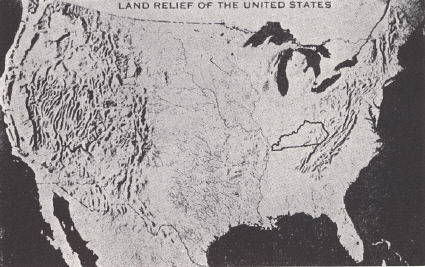 |
| FIG. 1. Relief map of the United States |
Outcropping Paleozoics range from Mid-Ordovician to Pennsylvanian, and the Cretaceous and Tertiary are developed in the Jackson Purchase and vicinity. Pleistocene alluvium occurs abundantly in the valleys of western Kentucky and in the Ohio River and its tributaries. Drift of this same age is found in the Ohio River counties from Oldham to Bracken, and occasional older erratics are found farther south.
The beds are gently warped and show marked disturbance only in the vicinity of pronounced faulting. Igneous rocks occur only as dikes in Elliott County in eastern Kentucky and in Caldwell and Crittenden counties and vicinity in western Kentucky.
The topography, except in the southeast, is that of several plateau levels in various stages of dissection with maximum relief in the eastern part of the state. These plateau levels are in part uplifted peneplains, but more frequently cuestas formed on gently dipping formations notably resistant to erosion. The topography has not been greatly affected by the Pleistocene glaciation as in the states to the north, and the varying regional features are the expression of erosion on various types of outcropping rock together with differential uplift, which has given rise to greater relief in the east. Several cycles of erosion are involved.