Trigg County. Coastal Plain landscape of the Purchase.
River downstream from U. S. Highway 68 west of Cadiz.
upper part of exposure and Jackson beds below.
County, Kentucky.
The Jackson Purchase region was bought from the Chickasaw Indians in 1818 and the territory divided between Kentucky and Tennessee in 1820 along the 36° 30' parallel. The government was represented in these negotiations by General Shelby of Kentucky and General Jackson of Tennessee. The name of the latter commissioner has been more popularly associated with the transaction, hence the name. It is the only portion of the state acquired since the introduction of the system of land survey used in the Northwest Territory and is thus the only part of the state laid off in sections.
The Purchase is defined as that part of Kentucky lying in the Gulf (or Mississippi) Embayment, a coastal plain region, and the area of outcrop of the unconsolidated or only semi-consolidated sediments of the Cretaceous and Tertiary. Its eastern margin is commonly accepted as the Tennessee River but the region lying between that river and the Cumberland ("Between the Rivers") is commonly associated with it. This section is transitional with the Mississippian Plateaus to the east and is included as a section of that area by Sauer (1927). The Mississippian outcrops in the valleys and the Cretaceous overlapping the Mississippian forms the divides. Rising with the regional dip it disappears over the hilltops to the east.
| PLATE LIV | |
|
|
|
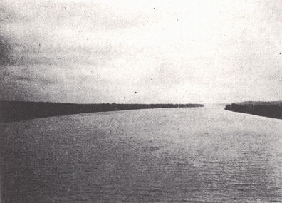
| FIG. 1. Cumberland River
upstream from U. S. Highway 68 west of Cadiz, Trigg County. Coastal Plain landscape of the Purchase. |
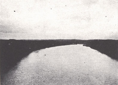
FIG. 2. Coastal Plain
landscape of the Purchase along the Tennessee River downstream from U. S. Highway 68 west of Cadiz. |
|
|
|
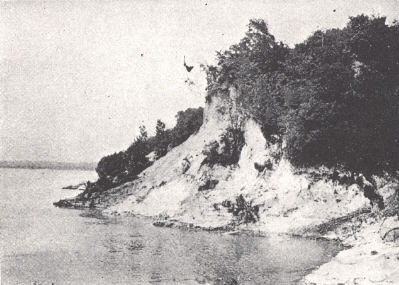
| FIG. 3. Mississippi River
bluffs at Columbus, Kentucky. Loess forming upper part of exposure and Jackson beds below. |
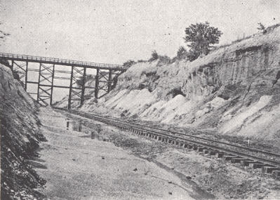
FIG. 4. Clay in the Grenada
formation near Baltimore Station, Hickman County, Kentucky. |
The region was a part of the coastal plain of a much more extensive Cretaceous and Tertiary Gulf of Mexico which has been subjected to a number of minor uplifts. Marine waters of the Gulf had not reached north as far as Kentucky with the exception of the early Eocene and perhaps the earliest Cretaceous. Sandstone dikes in the Porters Creek clay are evidence of diastrophic movement in the Eocene. The New Madrid earthquake (1811-12) resulted from a recent movement.
With the exception of a couple of low ridges forming divides west of the Tennessee River, it is an undulating plain with the elevation usually between 350 and 400 feet, and local relief of not much in excess of 50 feet except in the vicinity of a major stream. Dissection is greatest to the west and in the loess-covered region along the Mississippi River bluffs. The unconsolidated clay, gravel, and sand lends itself to rapid erosion, but gullying is not so marked as farther to the south in Tennessee. Over all the earlier formations rests a mantle of loam except where locally removed by erosion.
Floodplains of large extent are developed along the Mississippi, Ohio, and Tennessee rivers and to a smaller degree along the lesser streams. Most valleys preserve remnants of a floodplain developed at a higher level (second bottoms) not now subject to overflow. Paducah is located on the Big Bottoms. Swamps are numerous along the larger streams. River bluffs up to 100 feet in height with a protective cap of loess are developed along the Mississippi. Undercutting of such a bluff nearly destroyed the town of Columbus in 1927.
 |
|
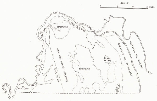
FIG. 22. Divisions of the Jackson Purchase (After Davis, 1923, modified) |
Davis (1923) has recognized seven divisions and an eighth is listed below.
Big Bottoms.—Fertile alluvial bottoms interrupted by sandy ridges (former natural levees) and sloughs more or less parallel to the river. It is subject to flood but is protected by levees south of Hickman.
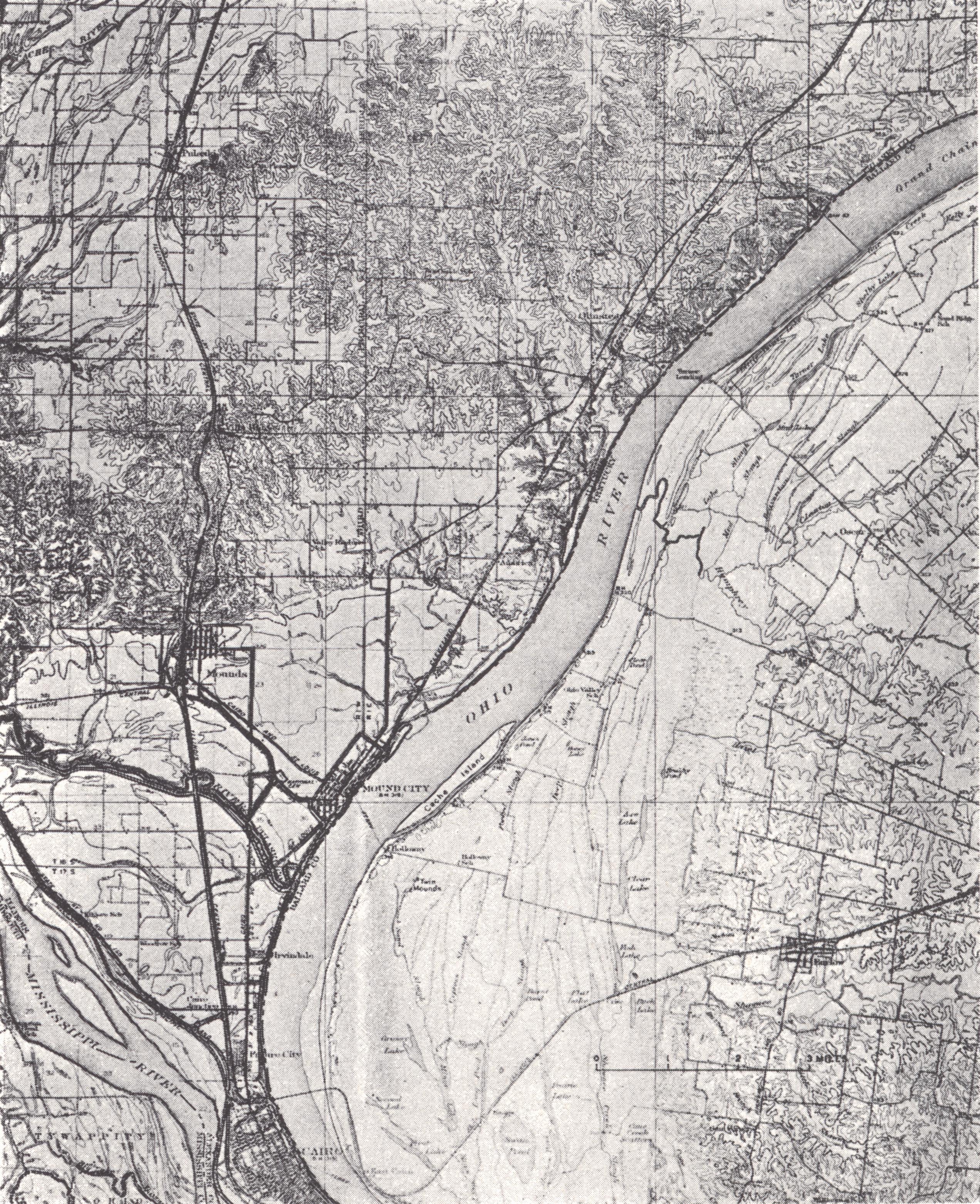 |
| PLATE LV Cairo topographic sheet, Kentucky- |
Second Bottoms.—These are remnants of a higher floodplain 25 to 35 feet above the lower and separated from it by a well-marked escarpment. It apparently represents an alluvial plain built by overloaded streams in flood during the melting of the Wisconsin ice sheet. Topographically it is rather similar to the Barrens, but is lower and was originally forested. The area is poorly drained, and agriculturally ranks below both the bottom lands and the loess area.
Cane Hills.—This includes the highly dissected loess-capped bluffs facing the bottoms and the more or less dissected rolling loess area to the east. With the disappearance of the loess cover, it merges with the central uplands. It is highly productive even where hilly.
Barrens.—(This term has been used also for the Pennyroyal.) A region marked by rather flat interstream areas, characterized in early days by the lack of forest cover. Agricultural prosperity is more a reflection of topography with a minimum of soil wash rather than soil character which is average.
Oak and Hickory Hills.—This is one of the largest divisions. The topography is hilly, soils thin, and erosion rapid. It is a division of rather limited agriculture.
Flatwoods.—Two small flat areas surrounded by the Oak and Hickory hills, a fairly prosperous farming section underlain by the Porters Creek clay.
Breaks of the Tennessee.—This includes the hilly portions of Marshall and Galloway counties with steep deeply washed slopes, often littered with the cherty Mississippian residuum. It marks the outcrop of the Ripley and is an area of limited resources. Much of it is suitable only for timber.
Between the Rivers (not included by Davis, 1923).—This section, not a part of the original purchase, marks a transition between the Purchase and the Pennyroyal to the east and is the main area of Cretaceous outcrop. It is a region of moderate roughness, underlain by the Mississippian, capped with the Cretaceous—a portion thus of the old gulf embayment. These loose and often badly gullied sediments have more or less blanketed the residual Mississippian limestone soils below, rendering the region inferior. It is covered with second and third growth timber. Much had been deforested earlier for the making of charcoal in connection with an early iron industry.