Contact:Dave Harris
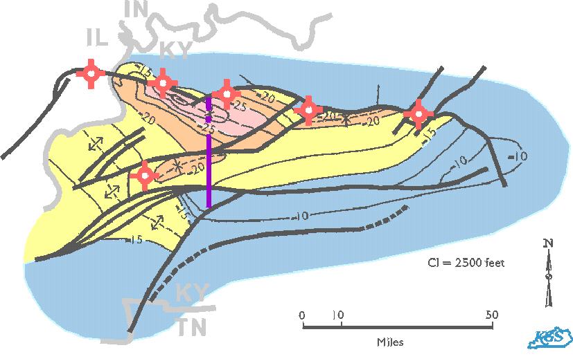
Preliminary structure contour map on the Cambrian-Precambrian unconformity, Rough Creek Graben, western Kentucky, showing the location of pre-Knox oil and gas tests. Blue line is line of section for the idealized cross section. Contour values are x1000 feet. Note that there is more then 30,000 feet of sediments in the northwest part of the graben. An update of this map has been made for part of the Rough Creek Graben (Wheeler and others, 1997).
Wheeler, R.L., Rhea, Susan, Diehl, S.F., Drahovzal, J.A., Bear, G.W., and Sargent, M.L., 1997, Seismotectonic map showing faults, igneous rocks, and geophysical and neotectonic features in the vicinity of the lower Wabash Valley, Illinois, Indiana, and Kentucky: U.S. Geological Survey, Geological Investigation Series, I-2583-D, 19 p.
This page prints best in landscape mode.