 |
 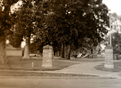
Douglass Park |
| This list of maps locates the segregated parks in Lexington (Map 2) and the segregated urban park systems in Kentucky's largest cities (Map 3). Map 1. is a pdf map of Douglass Park in 1954, derived from a landscaping blueprint. 178 Images of Leisure offers a cliackable map of Lexington's segregated parks and a tremendous photographic archive of these parks. The State of Black Kentucky includes the most comprehensive demographic maps found anywhere on the web or in print.
The State of Black Kentucky:
1. Douglass Park, 1954 (pdf: 50K) 2. Segregated Parks in Lexington, 1916-1956 (pdf: 200K) 3. African-American Urban Park Systems in Kentucky (pdf: 870K) 4. Aerial Photography of Douglass Park, 1931 (pdf: 1M) 5. Aerial Photography of Douglass Park, 1993 (pdf: 510) 6. Migration to Douglass Park from Surrounding Cities and Black Fayette County Schools Grounds (pdf: 500K) 7. The Evolution of a Landscape: Douglass Park, 1954 to 1993 (pdf: 50k) 8. Basic Map of Fayette County highlights the area in Map 5.(20K) 9. African-American Urban Parks in Lexington (13K)
|