
The Kentucky Geological Survey has archived this material, meaning (1) it is for reference, research, or recordkeeping; (2) it was created before April 24, 2026; (3) and the material has not been changed or altered since being archived. Please refer to our KGS Accessibility page for more information.
Introduction to the Digital Geologic Mapping Group
PurposeThe Kentucky Geological Survey is engaged in an ambitious program to put data from the 1:24,000-scale USGS geologic quadrangle maps into a spatial database by the end of 2003. This spatial database, linked to the other KGS databases (oil and gas, minerals, coal, and water), will create a complex and powerful spatial data engine, and serve the public by means of the Internet.
AcquisitionWe are collecting almost all data depicted on the paper maps, including formation contacts, faults, structure contours, major coal beds, mineral deposits, fossil locations and drill holes.
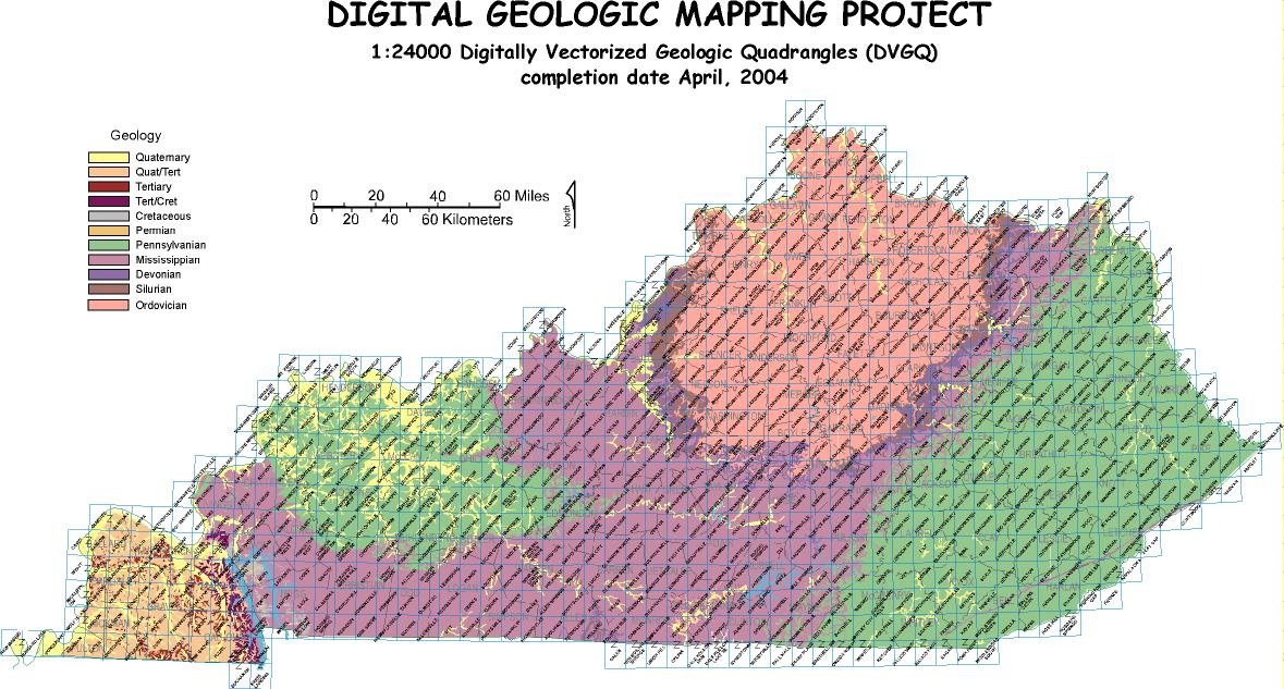
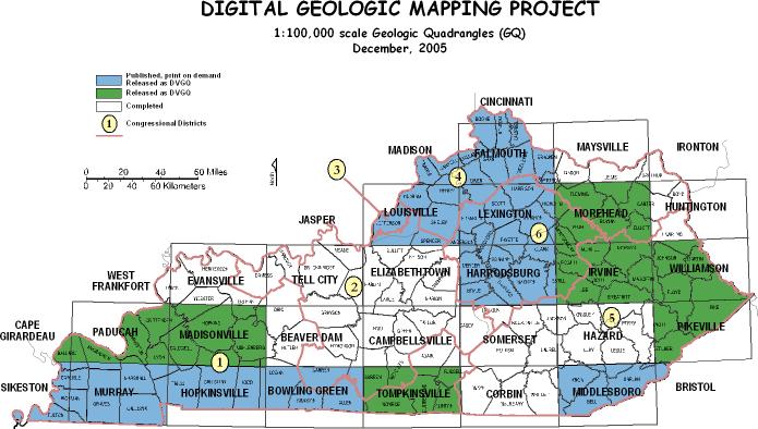
StatusThe Digital Geologic Mapping Program has completed the digital conversion of all 707 geologic quadrangles into digital format. This project was completed in April, 2004 and the National Cooperative Geologic Mapping Program provided funding, which was an integral part of the overall program. In this program geologic maps at a scale of 1:100,000 are compiled from 1:24,000 scale data and will be released as a Geologic Map Series.
Two status maps show progress made to date. The first gives the status of work completed for the 1:24,000 scale maps and the second shows those areas completed and released for the National Cooperative Geological Mapping Program (scale 1:100,000).
The digital mapping procedure consists of data acquisition, map compilation, database management, and data publication. We currently use a semi-automated vectorizing system to acquire the spatial data from the published geologic maps. Details of the procedure have been presented at three conferences of the USGS Digital Mapping Techniques, between 1997 - 2007, and can be found under Technical Reports.
Take our VIRTUAL TOUR of the complete vectorization process (including detailed images and descriptions of all stages of processing) to get a complete understanding.
Here is a list of some of the people working on this project, along with the details of the parts of the project they are working on. Part of our responsibility at KGS is answering public inquiries -- so if you have a question, be sure to ask!
If you have a common question, it may already be answered here.
These are some examples of digital mapping products that you can view and appreciate.