| Topography | ||
|
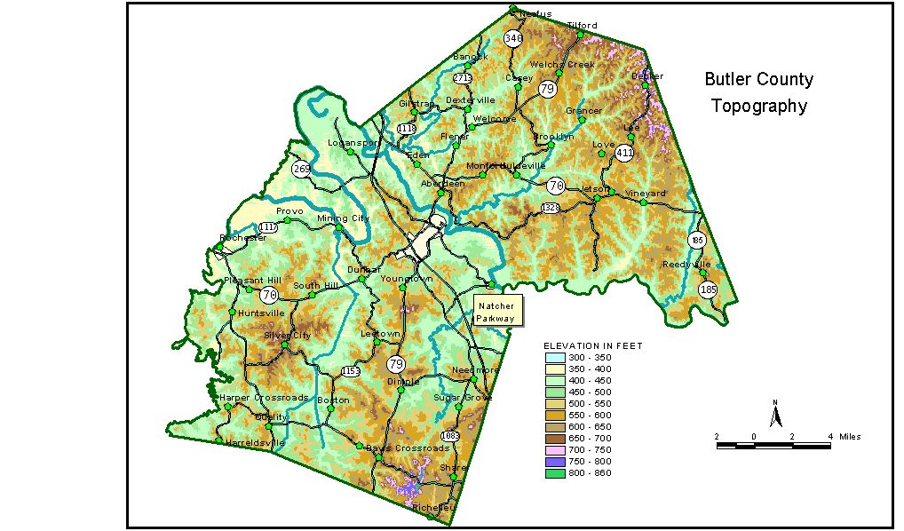
Discussion from McGrain and Currens (1978) Butler
County is located near the southeastern edge of the Western Kentucky
coal field. The meandering valley of Green River is the most conspicuous
topographic feature in the county. Green River marks portions of the
southern and northwestern boundaries and bisects the county in a northwesterly
direction. Great Bend, a large meander loop almost 9 miles long and
2 to 3 miles wide situated northwest of Morgantown, is a striking portion
of the valley. Taylor Lake at the northwestern end of Great Bend marks
a former channel of Green River. Highest elevation along the meander
spur is 590 feet. The area is well dissected by normal stream erosion. Flat-topped ridges
and alluviated valleys are common. The highest elevations are in the
southern part of the county where individual hills may attain elevations
in excess of 700 feet. The highest point is 810 feet on Peach Orchard
Knob. Other high elevations include Ragland Hill at 760 feet, Hanging
Rock at 740 feet, and an unnamed ridge 2 1/2 miles north of Quality
at 732 feet. Greatest local relief is along the bluffs of Green River
about 2 miles east of Morgantown where the difference in elevation between
the highest hills and the river is 340 to 350 feet. The elevation of Dunbar is 466 feet; Huntsville, 548 feet; Morgantown, at the courthouse, 573 feet; Rochester, 450 feet; and Woodbury, 450 feet. The 7.5-minute topographic quadrangle maps that cover the county are
shown, by name and by index code (Kentucky Natural Resources and Environmental
Protection Cabinet) on the index
map. Previous--Next--Back to "Groundwater Resources in Kentucky"
|
||