| Topography | ||
|
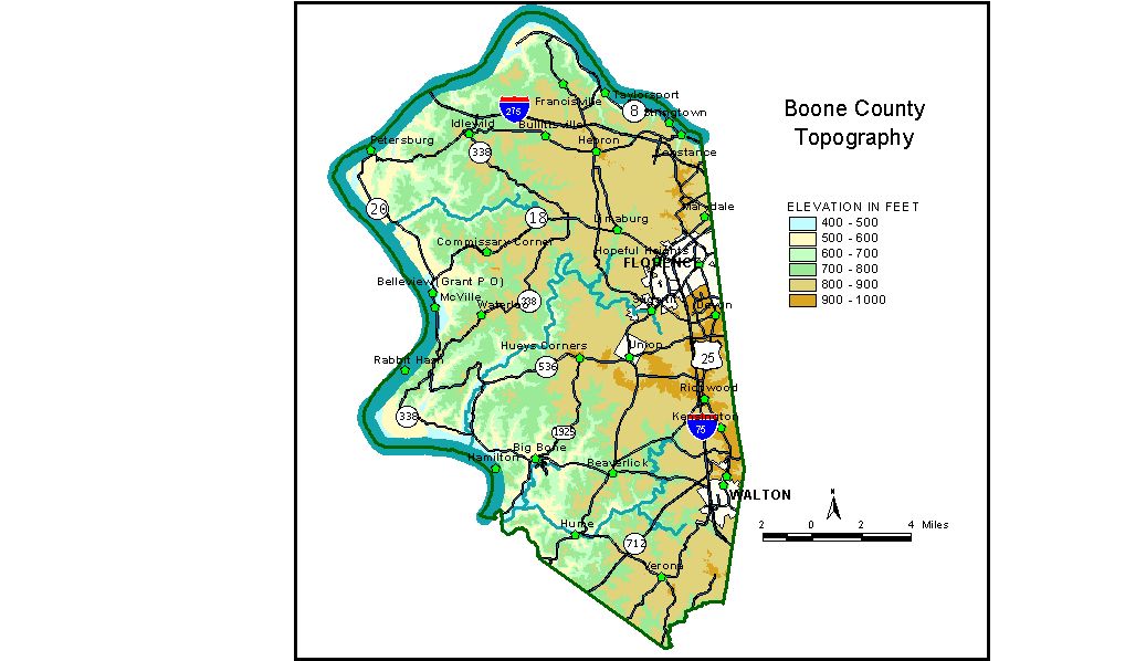
Discussion from McGrain and Currens (1978) Boone County is the northernmost county in Kentucky. The Ohio River, which forms the northern and western boundaries, has a marked influence on the topography of the county. The lowest elevation is 455 feet, the normal pool level of the Ohio River. Maximum local relief, 435 feet, is at the bluffs and steep slopes of the Ohio River at Constance. Local reliefs of 300 to 400 feet are found elsewhere along the Ohio. The highest elevation (greater than 964 feet) appears to be on a ridge midway between Walton and Kensington. Most of the county is a moderately to deeply dissected upland of the Outer Bluegrass Region. Local relief away from the river is commonly 100 to 200 feet. Some of the ridges between tributary valleys are flat-topped, particularly in the north-central part of the county, where elevations range from 800 to 900 feet. Many of these areas are the sites of local development, such as the Greater Cincinnati-Northern Kentucky Airport. Flat-topped ridges are less common in the western part of the county. The upland is more dissected by stream erosion, and the resulting topography is a maze of irregularly shaped hills and ridges separated by small valleys entrenched 100 to 250 feet below the upland. The floodplain along the Ohio River is narrow or absent; it is widest in the county downstream from Petersburg. One or more low terraces associated with unconsolidated silt, sand, and gravel deposits may be found at scattered points along the valley. The elevation of Big Bone Lick State Park is about 490 feet. Other
elevations are Belleview (Grant post office), 509 feet; Burlington,
the county seat, 846 feet; Florence, 935 feet; Taylorsport, 500 feet;
Verona, 890 feet; and Walton, 930 feet. The 7.5-minute topographic quadrangle maps that cover the county are shown, by name and by index code (Kentucky Natural Resources and Environmental Protection Cabinet) on the index map. Previous--Next--Back to "Groundwater Resources in Kentucky"
|
||