| Topography | ||
|
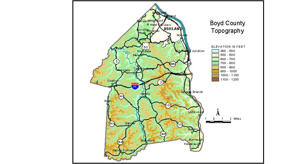
Discussion from McGrain and Currens (1978) Boyd County, located in northeastern Kentucky, is bounded on the east by the Ohio and Big Sandy Rivers and on the north by the Ohio River. Although it is part of the Eastern Kentucky Coal Field, its topography is not as rugged as that of the counties to the south and southwest in the same region. The highest elevations in the county are on the drainage divide between the Big Sandy and Little Sandy Rivers in the southern part of the county. Many of the elevations here are greater than 1,000 feet, the highest being approximately 1,140 feet. The lowest elevation is 515 feet, the normal pool level of the Ohio River where it leaves the county. The area is well dissected. Flat areas are few, except along stream valleys. Local reliefs of 200 to 300 feet are common. The greatest local relief is in the southeastern corner of the county, where differences in elevation between the valley of the Big Sandy River and the adjacent ridgetops may exceed 450 feet. The elevation in downtown Ashland at the post office is 558 feet; other places in the city may be as much as 300 feet higher. Other points of interest are Boltsfork, 652 feet; Cannonsburg, 605 feet; Catlettsburg, the county seat, 555 feet; High Knob, a hill on the Boyd-Greenup County line, 1,050 feet; Princess, 603 feet; and Rush, 650 feet. The 7.5-minute topographic quadrangle maps that cover the county are shown, by name and by index code (Kentucky Natural Resources and Environmental Protection Cabinet) on the index map. Previous--Next--Back to "Groundwater Resources in Kentucky"
|
||