| Topography | ||
|
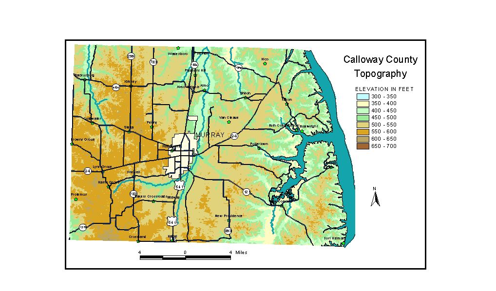
Discussion from McGrain and Currens (1978) Calloway
County is located in the Mississippi Embayment area of western Kentucky.
Kentucky Lake marks the eastern boundary of the county, and the southern
boundary is the Kentucky-Tennessee state line. The surface of Kentucky Lake, the lowest point in the county, is 359
feet. Local differences in elevation rarely exceed 50 feet, except adjacent
to drainage lines, where differences in elevation between valley bottoms,
including Kentucky Lake, and the upland surface may be 100 to more than
150 feet. Some high points along Kentucky Lake in the southern part
of the county have a maximum local relief as great as 160 feet. Stream
gradients are low and some valley flats are subject to flooding. Some
swamps are present along Clarks River. Elevations of communities are Alamo, 428 feet; Coldwater, 545 feet; Dexter, 412 feet; Hazel, 561 feet; Kirksey, 555 feet; Lynn Grove, 575 feet; Murray, at the courthouse, 515 feet; and New Concord, 420 feet. The 7.5-minute topographic quadrangle maps that cover Calloway County
are shown, by name and by index code (Kentucky Natural Resources and
Environmental Protection Cabinet) on the index
map. Previous--Next--Back to "Groundwater Resources in Kentucky"
|
||