| Topography | ||
|
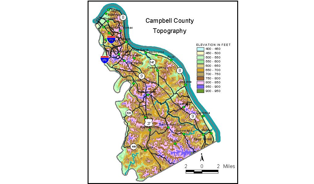
Discussion from McGrain and Currens (1978) Campbell
County, located in the Outer Bluegrass Region in northern Kentucky,
is bounded by streams on three sides -- the Ohio River on the east and
north and the Licking River on the west. The lowest elevation in the
county is 455 feet at the confluence of the Ohio and Licking Rivers. The upland areas range from approximately 900 feet in the south to
750 feet in the north. The highest elevation is 920 feet, a ridge on
the divide between the Ohio and Licking Rivers near the southern boundary
of the county. The greatest local reliefs appear to be along the valley
of the Licking River in the central and southern parts of the county,
where differences in elevation between the stream and the adjacent hills
may be as great as 400 feet. The hills above Newport are approximately
300 feet above the Ohio River. Elevations of communities are Alexandria, the county seat, 823 feet; Bellevue, 545 feet; Dayton, 515 feet; Fort Thomas, 810 feet; and Newport, 514 feet. The 7.5-minute topographic quadrangle maps that cover Campbell County
are shown, by name and by index code (Kentucky Natural Resources and
Environmental Protection Cabinet) on the index
map. Previous--Next--Back to "Groundwater Resources in Kentucky"
|
||