| Topography | ||
|
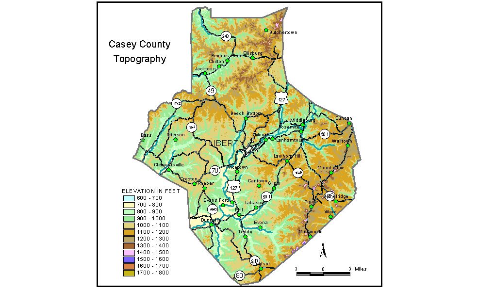
Discussion from McGrain and Currens (1978) Casey
County is located in the Mississippian Plateaus area of south-central
Kentucky. It is a well-dissected upland area with rather broad valleys
and numerous long, flat-topped ridges. Elevations of the flat ridgetops
are commonly about 1,100 feet in the north-central, central, and southern
parts of the county. In the extreme northern part of the county, individual
knobs and nearly flat ridges may have elevations ranging between 1,300
and 1,400 feet. Chicken Gizzard Ridge, for example, is 10 miles long
and has elevations between 1,000 and 1,260 feet. The Green River and its tributaries drain most of Casey County. This
stream crosses the county from east to west. The floodplain has an elevation
of 860 feet on the east and 720 feet on the west. Broad flats occur
along this valley and some of its larger tributaries. The lowest elevation
in the county is 710 feet where the Green River leaves the county. The
flood pool of Green River Lake, elevation 713 feet, barely reaches Casey
County. (The normal pool level of Green River Lake is 675 feet.) The northern part of the county is drained by tributaries of Rolling Fork. Normal stream drainage has so dissected the upland area that the Muldraugh Escarpment (Highland Rim) in this part of Kentucky has essentially lost its identity, and instead of presenting a single cuesta is a mass of irregular knobs and ridges rising 400 feet or so above the larger valleys. Slopes throughout the county are steep, but there is rarely an unscalable
bluff. Local reliefs of 200 to 250 feet are common over much of the
county, but may exceed 300 to 400 feet in the extreme northern area
and near the high knobs in the southeast. The difference in the elevations
between the top of Green River Knob and a tributary of Turkey Creek
just 1/2 mile away is 820 feet. The elevation at Clementsville is 771 feet; Dunnville, 750 feet; Liberty, at the courthouse, 816 feet; Middleburg, 840 feet; Mintonville, 1,200 feet; and Yosemite, 836 feet. The 7.5-minute topographic quadrangle maps that cover Casey County
are shown by name and index code (Kentucky Natural Resources and Environmental
Protection Cabinet) on the index
map. Previous--Next--Back to "Groundwater Resources in Kentucky"
|
||