| Topography | ||
|
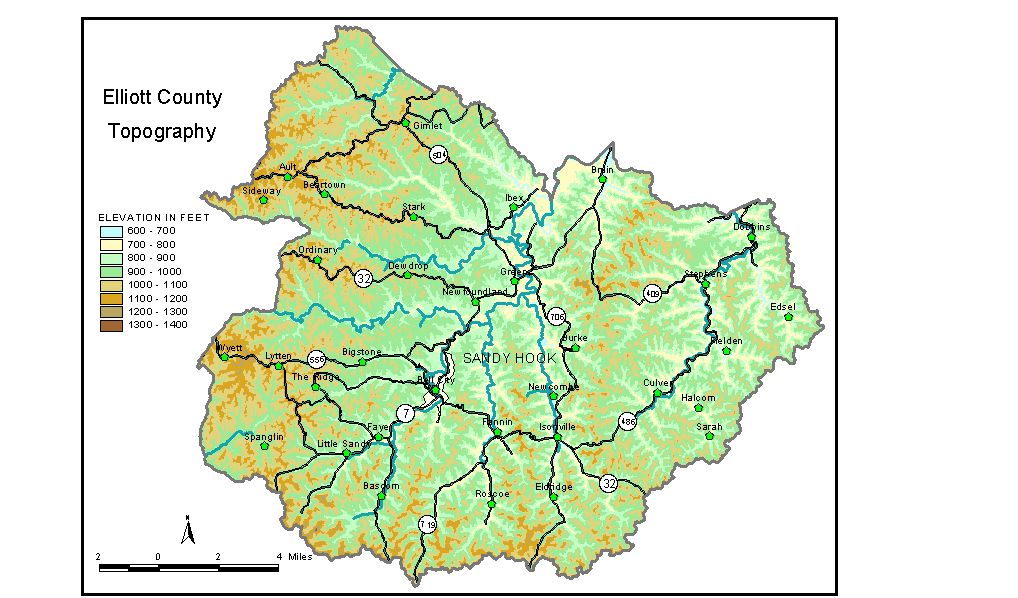
Discussion from McGrain and Currens (1978) Elliott
County is located in the coal field area of northeastern Kentucky.
It is a well-dissected upland area. Local reliefs of 250 to 300 feet
are common. Locally, precipitous sandstone bluffs rim the valley walls. The lowest elevation in the county is about 645 feet. This is the normal
pool level of Grayson Lake and the approximate elevation of Little Fork
of Little Sandy River at the Elliott-Carter County line. The elevation of Sandy Hook, the county seat, is 775 feet. Other elevations include Ault, 1,133 feet; Bell City, 770 feet; Isonville, 690 feet; Little Sandy, 790 feet; and Newfoundland, 802 feet. The 7.5-minute topographic quadrangle maps that cover Elliott County
are shown, by name and by index code (Kentucky Natural Resources and
Environmental Protection Cabinet) on the index
map. Previous--Next--Back to "Groundwater Resources in Kentucky"
|
||