| Topography | ||
|
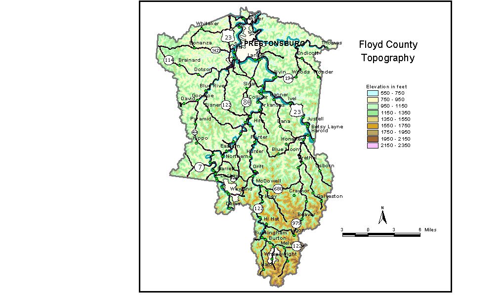
Discussion from McGrain and Currens (1978) Floyd
County is located in the mountainous Eastern Kentucky Coal Field.
The area is a completely dissected upland in which valleys and ridges
occupy about equal amounts of land. Almost the only flat land in the
county is found in the narrow valley flats along Levisa Fork of the
Big Sandy River and some of its tributaries. The highest elevation in Floyd County is 2,320 feet, in the extreme
southern part of the county in the vicinity of the junction of Floyd,
Knott, and Pike Counties. The lowest elevation is approximately 580
feet, at the point where Levisa Fork of the Big Sandy River leaves the
county. Dewey Lake, an impoundment on Johns Creek, has a normal pool
elevation of 645 feet. All the communities are located in the valleys. The elevation of Prestonsburg,
the county seat, is 630 feet. Other elevations include Allen, 650 feet;
Auxier, 629 feet; Betsy Lane, 671 feet; David, 680 feet; Drift, 684
feet; Dwale, 650 feet; Harold, 664 feet; Hi Hat, 815 feet; Lancer, 633
feet; Langley, 650 feet; Martin, 640 feet; McDowell, 707 feet; Wayland,
714 feet; and Wheelwright, 1,102 feet. The 7.5-minute topographic quadrangle maps that cover Floyd County are shown, by name and by index code (Kentucky Natural Resources and Environmental Protection Cabinet) on the index map. Previous--Next--Back to "Groundwater Resources in Kentucky"
|
||