| Topography | ||
|
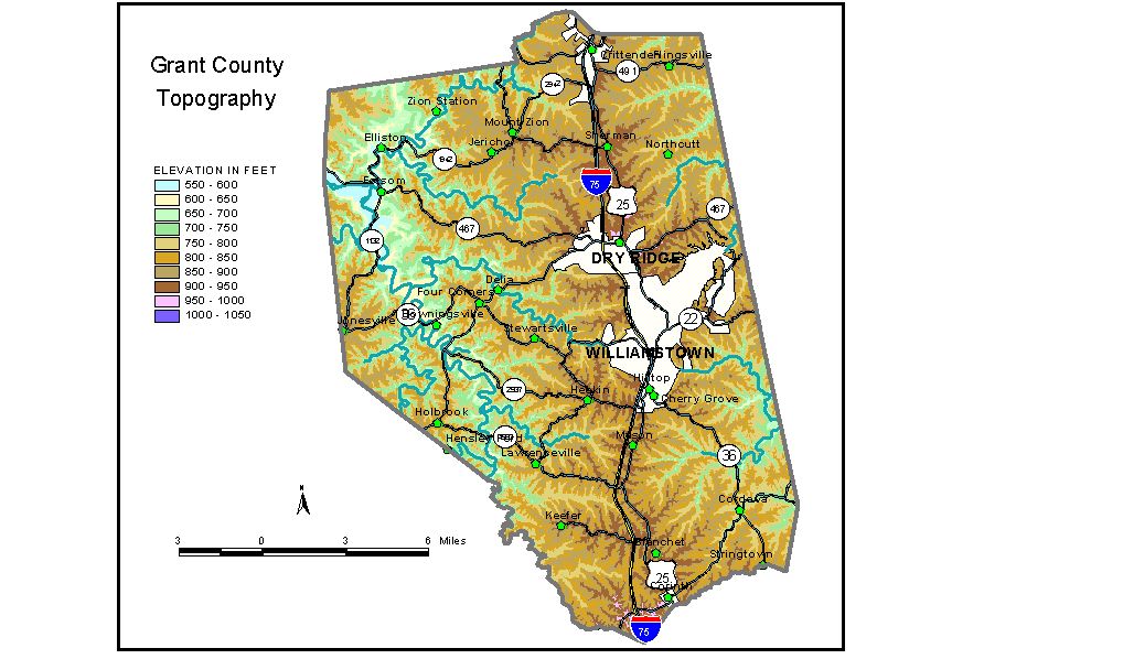
Discussion from McGrain and Currens (1978) Grant
County is in the highly dissected Outer Bluegrass Region. Ridgetop
elevations in excess of 900 feet are common. Local reliefs along principal
drainage lines are generally in excess of 150 feet, but in places are
almost 300 feet. The highest elevations in the county are found along and adjacent to
Ky. 330, 2 miles southwest of Corinth. Here, on a drainage divide between
Eagle and Three Forks Creeks, elevations of 1,000 feet have been recorded.
Many elevations on the north-south divide between the Licking River
and Eagle Creek drainage systems in the Dry Ridge-Williamstown area
are between 950 and 980 feet. Farther north they decline to approximately
920 feet at the Grant-Kenton County line. The elevation of Williamstown, the county seat, is 974 feet. Other
elevations are Corinth, 980 feet; Crittenden, 920 feet; Dry Ridge, 958
feet; Elliston, 588 feet; Jonesville, 914 feet; and Mount Zion, 925
feet. The spillway elevation of Boltz Lake is 826 feet; the spillway at Corinth Lake is 840 feet, and the one at Williamstown Lake is 785 feet. The 7.5-minute topographic quadrangle maps that cover Grant County
are shown, by name and by index code (Kentucky Natural Resources and
Environmental Protection Cabinet) on the index
map. Previous--Next--Back to "Groundwater Resources in Kentucky"
|
||