| Topography | ||
|
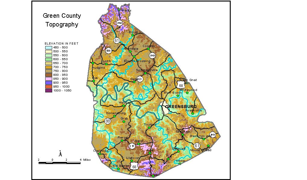
Discussion from McGrain and Currens (1978) Green
County is in the Mississippian Plateaus Region of south-central
Kentucky. It is primarily a limestone plateau area with upland elevations
generally in excess of 750 feet. The incised, meandering valley of the
Green River traverses the county from east to west and is the most conspicuous
topographic feature. Local reliefs of 150 feet between Green River and
the adjacent upland are common. Locally, the ridgetops may be flat,
but many are narrow. Sinkholes and springs are abundant in the karst
area in the vicinity of Big Brush Creek in the northwestern part of
the county. Features associated with underground drainage are present
in other parts of the county, but are not nearly as conspicuous. The elevation of Greensburg, the county seat, at the junction of U.S. 68 and Ky. 61, is 632 feet. Other elevations are Gabe, 768 feet; Pierce, 803 feet; Summersville, 820 feet; and Thurlow, 817 feet. The 7.5-minute topographic quadrangle maps that cover Green County
are shown, by name and by index code (Kentucky Natural Resources and
Environmental Protection Cabinet) on the index
map. Previous--Next--Back to "Groundwater Resources in Kentucky"
|
||