| Topography | ||
|
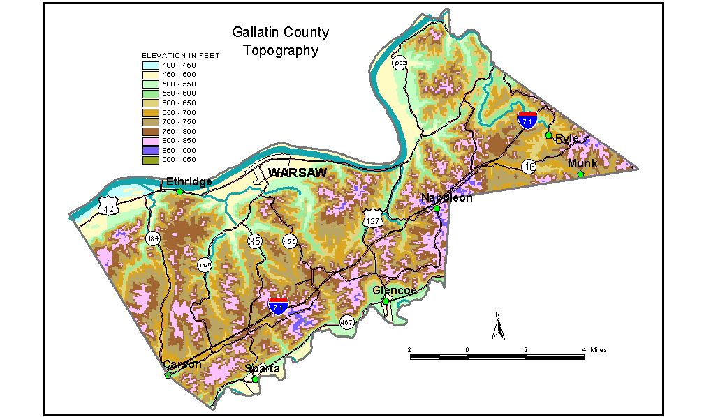
Discussion from McGrain and Currens (1978) Gallatin
County is located in the Outer Bluegrass Region in north-central
Kentucky. The Ohio River marks the northern boundary, and Eagle Creek
marks part of the southern boundary. The county is a well-dissected upland. The principal areas of flat
land are in the valleys of the Ohio River and Eagle Creek. Only in the
southwestern corner of the county are there any significant number of
flat-topped ridges. Ridgetop elevations are generally above 750 to 800
feet. The highest elevations appear to be on or near the divide between
the Ohio River and Eagle Creek in the southern part of the county. The
highest elevation, 920 feet, is on a ridge between Eagle Creek and Interstate
71, approximately 3 miles west of Glencoe. The elevation of Warsaw, at the courthouse, is 495 feet. The highest point on Johnson Hill, a bluff immediately south of the city, is 854 feet. Glencoe and Sparta, both located in Eagle Creek Valley, have elevations of 544 and 503 feet, respectively. The 7.5-minute topographic quadrangle maps that cover Gallatin County
are shown, by name and by index code (Kentucky Natural Resources and
Environmental Protection Cabinet) on the index
map. Previous--Next--Back to "Groundwater Resources in Kentucky"
|
||