| Topography | ||
|
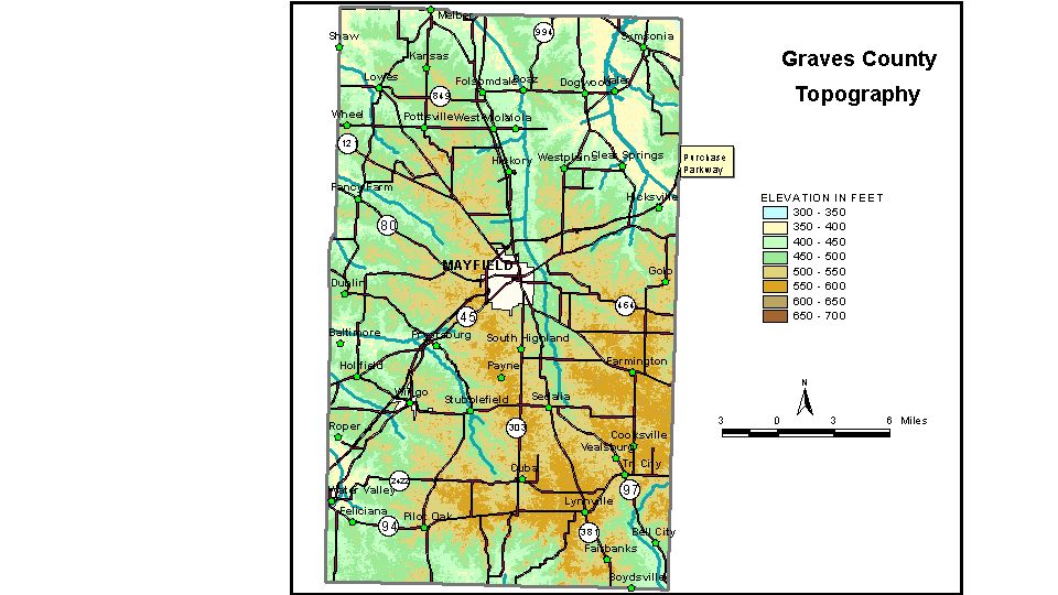
Discussion from McGrain and Currens (1978) Graves
County, in the Mississippi Embayment Region of western Kentucky,
is a gently rolling plain of low relief. Slopes are gradual, and local
relief is generally less than 100 feet, in many places less than 50
feet. The south- and west-facing slopes of the principal streams are
generally steeper than the east- and north-facing slopes. The lowest elevation, approximately 321 feet, is the point where the
West Fork of the Clarks River enters McCracken County. Elevations of
the valley flats in this area are between 335 and 340 feet. The elevation
of the valley bottom of Mayfield Creek at the northwestern corner of
the county is 340 to 350 feet. The valleys of the Clarks River and Mayfield,
Obion, and Wilson Creeks are broad and have low gradients. Swampy and
other poorly drained topography is indicated. The elevation of Mayfield, at the courthouse, is 480 feet. Elevations at other communities are Boaz, 395 feet; Cuba, 520 feet; Dublin, 500 feet; Fancy Farm, 440 feet; Farmington, 560 feet; Folsomdale, 440 feet; Lowes, 473 feet; Lynnville, 560 feet; Melber, on the Graves-McCracken County line, 375 feet; Sedalia, 506 feet; Symsonia, 405 feet; Tri City, 522 feet; Water Valley, 387 feet; and Wingo, 469 feet. The 7.5-minute topographic quadrangle maps that cover Graves County
are shown, by name and by index code (Kentucky Natural Resources and
Environmental Protection Cabinet) on the index
map. Previous--Next--Back to "Groundwater Resources in Kentucky"
|
||