| Topography | ||
|
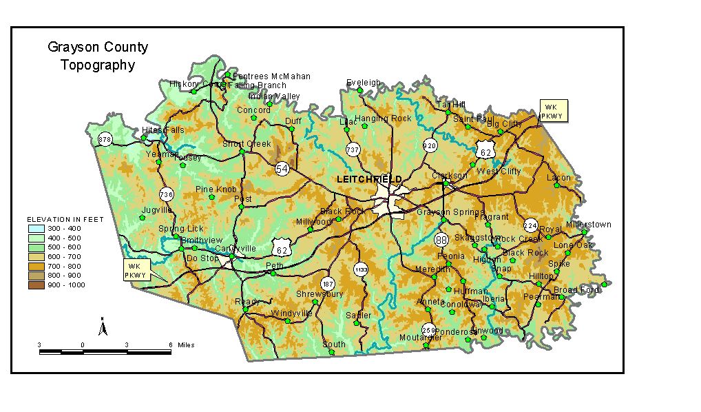
Discussion from McGrain and Currens (1978) Grayson
County occupies an upland area that includes parts of the Mississippian
Plateaus Region west of the Dripping Springs Escarpment and the eastern
edge of the Western Kentucky Coal Field. Much of the area is characterized
by flat-topped, sandstone-capped ridges. This flat appearance is broken
by occasional knobs and ridges rising above the general plateau level
and valleys incised 150 to 200 feet into the upland. Karst features
such as sinking streams, sinkholes, and springs are present locally
in the eastern part of the county. The Rough River and its tributaries form the northern boundary of Grayson
County. The lowest elevation is approximately 395 feet, at the point
where the Rough River leaves the county. Rough River Lake, a flood-control
facility on the Rough River, has a normal pool elevation of 495 feet
and a flood-pool elevation of 524 feet. Nolin Lake on the Nolin River marks part of the southern border of the county. It has a normal pool elevation of 515 feet and a flood-pool elevation of 560 feet. Leitchfield, the county seat, has an elevation at the courthouse of approximately 750 feet. The elevations of other communities are Big Clifty, 752 feet; Caneyville, 490 feet; Clarkson, 730 feet; Millerstown, 589 feet; Millwood, 673 feet; Peonia, 778 feet; Shrewsbury, 660 feet; and Spring Lick, 460 feet. The 7.5-minute topographic quadrangle maps that cover Grayson County
are shown, by name and by index code (Kentucky Natural Resources and
Environmental Protection Cabinet) on the index
map. Previous--Next--Back to "Groundwater Resources in Kentucky"
|
||