| Topography | ||
|
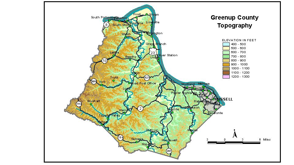
Discussion from McGrain and Currens (1978) Greenup
County is a well-dissected upland area in northeastern Kentucky.
Except for a few scattered ridgetops near the western boundary and in
the Flatwoods area of northeastern Greenup County, the only flat land
is found along the valleys of the Ohio and Little Sandy Rivers and Tygarts
Creek. The lowest point is 485 feet, the normal pool level of the Ohio River
where it leaves the county. Valley flats along the river are variable
in width. Terraces are recognizable along some stretches of the river,
and the elevations of the floodplain range from 520 to 560 feet. Differences
in The elevation of Greenup, the county seat, is 536 feet. Other elevations are Argillite, on Little Sandy River, 545 feet; Bellefonte, 671 feet; Flatwoods, at the junction of Ky. 207 and 750, 689 feet; Russell, on the railroad, 550 feet, and at the high school, 670 feet; South Portsmouth, 550 feet; South Shore, 542 feet; Worthington, 550 feet; and Wurtland, 549 feet. The 7.5-minute topographic quadrangle maps that cover Greenup County
are shown, by name and by index code (Kentucky Natural Resources and
Environmental Protection Cabinet) on the index
map. Previous--Next--Back to "Groundwater Resources in Kentucky"
|
||