| Topography | ||
|
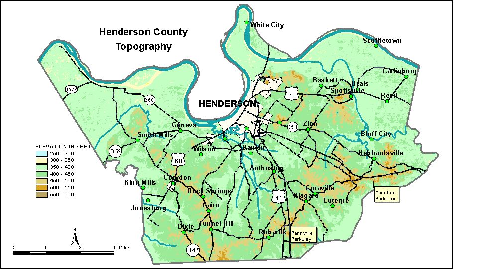
Discussion from McGrain and Currens (1978) Henderson County is located in northwestern Kentucky in the Western Kentucky coal field. The Ohio River and its ancient channel form the northern boundary of the county. The broad flood plain along the river with elevations of 350 to 370 feet is one of the most striking topographic features of the county. Sloughs, marshes, and flood scours modify the valley floor. The normal pool level of the Ohio River, 331 feet, is the lowest elevation in the county. South of the flood plain the terrain is rolling. The greatest local
relief and the highest elevations are found in the bluffs adjacent to
the flood plain. The highest elevation in the county, 588 feet, is in
Wolf Hills, northeast of Henderson. This point is more than 200 feet
above the adjacent flood plain. The highest point in nearby Audubon
Memorial State Park is 567 feet. Henderson is the county seat, and the elevation at the courthouse is approximately 400 feet. The elevations of other communities are Anthoston, 460 feet; Baskett, 400 feet; Corydon, 460 feet; Dixie, 158 feet; Geneva, 389 feet; Hebbardsville, 423 feet, Reed, 378 feet; Smith Mills, 410 feet; Spottsville, 140 feet; and Zion, 424 feet. The 7.5-minute topographic quadrangle maps that cover the county are
shown, by name and by index code (Kentucky Natural Resources and Environmental
Protection Cabinet) on the index
map. Previous--Next--Back to "Groundwater Resources in Kentucky"
|
||