| Topography | ||
|
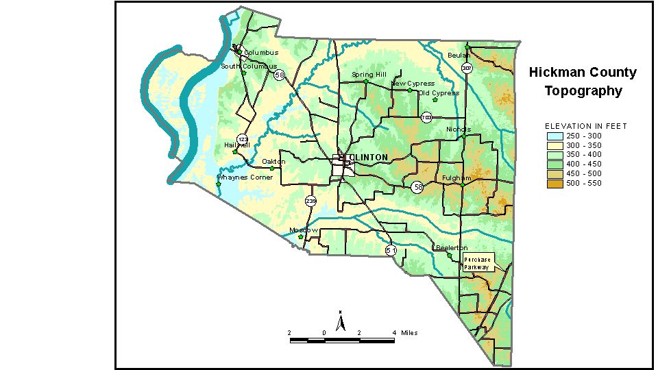
Discussion from McGrain and Currens (1978) Hickman
County, in the Mississippi Embayment region, is a gently rolling
area adjacent to the Mississippi River. Upland ridges and hills rarely
attain elevations of 500 feet. The highest point, 510 feet, is on the
divide between Obion and Sand Creeks about 2 1/2 miles south-southeast
of Fulgham. The lowest elevation is approximately 276 feet, the point where the
Mississippi River leaves the county. The valleys of Bayou du Chien and Obion Creek have low gradients. Obion
Creek is a braided stream, and some swampy areas and small oxbow lakes
are present along the valley. The elevation of Clinton, the county seat, is about 385 feet; Columbus is 464 feet; Fulgharn is 475 feet; and Oakton is 324 feet. The 7.5-minute topographic quadrangle maps that cover the county are
shown, by name and by index code (Kentucky Natural Resources and Environmental
Protection Cabinet) on the index
map. Previous--Next--Back to "Groundwater Resources in Kentucky"
|
||