| Topography | ||
|
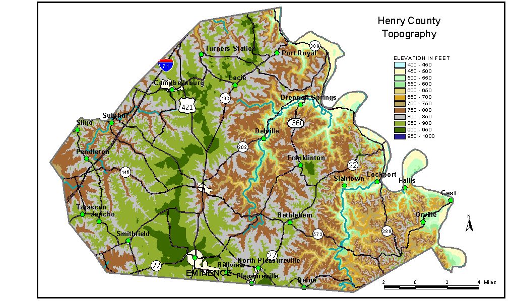
Discussion from McGrain and Currens (1978) Henry
County is a rolling to hilly area, well dissected by normal stream
erosion, in the Outer Blue Grass region of north-central Kentucky. The
Kentucky River marks the eastern boundary of the county and is the area
of greatest local relief. The flood plain has elevations of 460 to 490
feet, and the adjacent hills are 200 to 350 feet higher. Where broad
meander loops of the river cut into the upland, the valley walls are
very steep, almost precipitous. Elsewhere, few cliffs occur. The lowest
elevation is approximately 425 feet, the level of the Kentucky River
where it leaves the county. The elevation of New Castle, at the courthouse, is 844 feet. Other elevations are Bethlehem, 880 feet; Campbellsburg, 915 feet; Eminence, at the intersection of Kentucky Highway 55 and the Louisville and Nashville Railroad, 939 feet; Franklinton, 868 feet; Lockport, 470 feet; North Pleasureville, 893 feet; Smithfield, 891 feet; and South Pleasureville, 898 feet. The 7.5-minute topographic quadrangle maps that cover the county are
shown, by name and by index code (Kentucky Natural Resources and Environmental
Protection Cabinet) on the index
map. Previous--Next--Back to "Groundwater Resources in Kentucky"
|
||