| Topography | ||
|
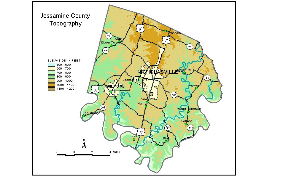
Discussion from McGrain and Currens (1978) Jessamine
County is in the Blue Grass region of Kentucky, lying mostly in
the Inner Blue Grass. The terrain is generally gently to mildly rolling,
but in the area southeast of lower Hickman Creek in the Little Hickman-Pollard
part of the county it becomes hilly, more typical of the Outer Blue
Grass. In the upland area away from the river, elevations of 950 to 1000 feet
are common. Ridgetops may be flat or nearly so. Karst features are locally
conspicuous but do not dominate the landscape. The highest point in
the county appears to be 1072 feet, on a ridge just west of the Southern
Railroad about 3 miles north of Nicholasville. The elevation of Nicholasville, the county seat, is 930 feet. Elevations at other communities are High Bridge, 750 feet; Keene, 911 feet; Spears, 994 feet; and Wilmore, 926 feet. The Southern Railroad bridge (High Bridge) over the Kentucky River at the community of High Bridge is at an elevation of 795 feet, 281 feet above the stream. The 7.5-minute topographic quadrangle maps that cover the county are
shown, by name and by index code (Kentucky Natural Resources and Environmental
Protection Cabinet) on the index
map. Previous--Next--Back to "Groundwater Resources in Kentucky"
|
||