| Topography | ||
|
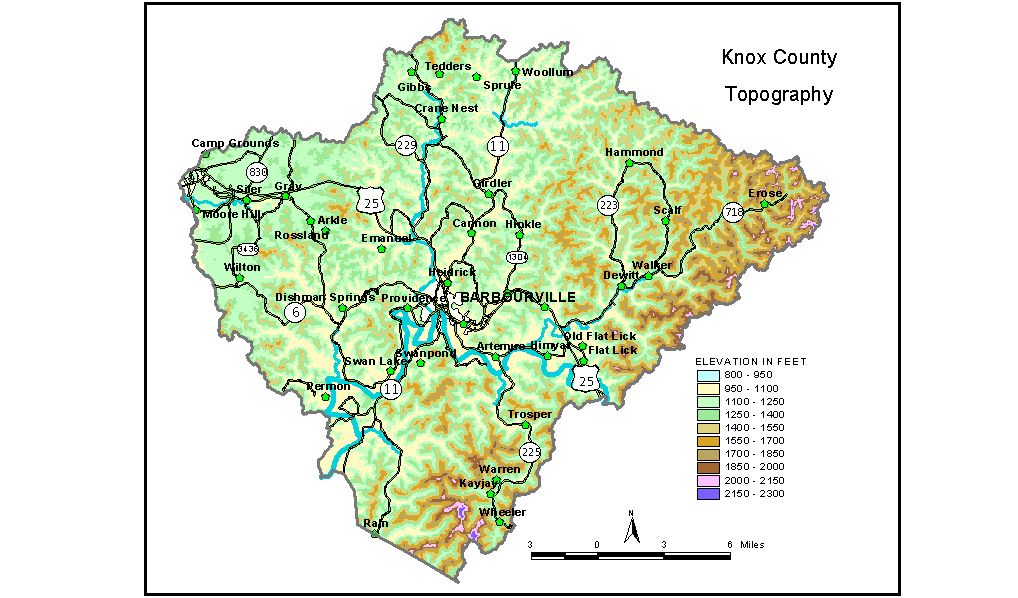
Discussion from McGrain and Currens (1978) Knox
County is in the southern part of the Eastern Kentucky coal field.
The area is generally mountainous. Ridgetop elevations range from 1,300
feet at Corbin in extreme western Knox County to 2,000 feet or more
in the southern and eastern extremities. The highest elevation is 2,322
feet, on a mountain peak near the Knox-Bell County line 2 miles south-southwest
of Kayjay. The difference in elevation between the top of this mountain
and the valley of Brush Creek, one mile east, is more than 1,100 feet. The principal areas of flat land are in the valleys of Cumberland River
and Lynn Camp Creek and in the lower reaches of some of their tributaries.
The valley flats along the Cumberland range from 940 to 1,000 feet.
Cumberland River leaves the county at an elevation of 930 feet, and
Lynn Camp Creek leaves the county at Corbin at 1,050 feet. The elevation of Barbourville, at the courthouse, is 986 feet. Elevations at other communities are Artemus, 1,016 feet; Boone Heights, 1,000 feet; Flat Lick, 1,022 feet; Fount, 904 feet; Gray, 106 feet; Heidrick, 983 feet; KayJay, 1,060 feet; and Walker Memorial State Park, 1,000 feet. The 7.5-minute topographic quadrangle maps that cover the county are
shown, by name and by index code (Kentucky Natural Resources and Environmental
Protection Cabinet) on the index
map. Previous--Next--Back to "Groundwater Resources in Kentucky"
|
||