|
|
|
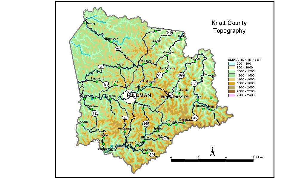
Discussion from McGrain and Currens (1978)
Knott
County is in the mountainous Eastern Kentucky coal field. The area
is highly dissected by
normal stream erosion. Ridges and valleys occupy about equal portions
of the landscape. Few
large streams are present, and there is a general absence of flat land
except narrow strips in the
valley bottoms. The lowest elevation, about 675 feet, is at the mouth
of Jones Fork where it joins
the Right Fork of Beaver Creek.
Upland elevations commonly exceed 1,400 feet. Local reliefs of 500 to
800 feet are common,
generally being greater in the eastern part of the county than in the
west. The highest elevations
occur in the extreme southern and southeastern parts of the county where
mountaintop elevations
in excess of 2,000 feet are present. These elevations are found along
and near the Knott-Floyd,
Knott-Pike, and Knott-Letcher County boundaries. The highest point in
the county is 2,360 feet,
on a mountain at the head of Arnold Fork at the junction of Knott, Letcher,
and Pike Counties.
The elevation of Hindman, the county seat, is 1,031 feet. Elevations
at other communities are
Carr Creek, 1,009 feet; Carrie, 990 feet; Kite, 879 feet; Mousie, 785
feet; Pippa Passes, 1002
feet; and Sassafras, 947 feet.
The 7.5-minute topographic quadrangle maps that cover the county are
shown, by name and by index code (Kentucky Natural Resources and Environmental
Protection Cabinet) on the index
map.
Previous--Next--Back
to "Groundwater Resources in Kentucky"
|