| Topography | ||
|
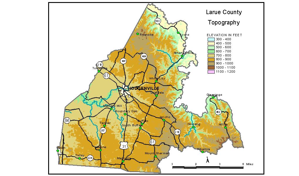
Discussion from McGrain and Currens (1978) Larue
County is in the Mississippian Plateaus area of Kentucky. Rolling
Fork, which marks part of the eastern boundary of the county, follows
along or near the base of Muldraugh Hill (Highland Rim). The most striking
topography in the county is the Muldraugh escarpment which rises 300
to 350 feet above the valley flats. Steep slopes are present, but sheer
cliffs are rare. Most of Larue County is a low, rolling plateau. Elevations in the northeast
at the highest points on Muldraugh Hill (near Kentucky Lincoln Trail
and Cecil Ridge) are 1020 feet. The plateau surface declines to the
southwest to approximately 750 feet at the western county boundary.
Sinkholes are a common feature of the terrain in the western part of
the county; elsewhere normal surface stream drainage predominates. The highest elevations in the county are found along the drainage divide
that marks the boundary between Larue and Green Counties and Larue and
Taylor Counties. Elevations in excess of 1000 feet are common here.
The highest elevation is found along the Larue-Taylor County line, where
1080 foot contours have been recorded. Hodgenville is the county seat; the elevation at the town square is 730 feet. Elevations at other points of interest are: the entrance to Lincoln Memorial National Historic Park, 774 feet; Abraham Lincoln Boyhood Home, 525 feet; Buffalo, 759 feet; Magnolia, 860 feet; Tonieville, 746 feet; Upton, on the Larue-Hardin County line, 750 feet; and White City, 851 feet. The 7.5-minute topographic quadrangle maps that cover the county are
shown, by name and by index code (Kentucky Natural Resources and Environmental
Protection Cabinet) on the index
map. Previous--Next--Back to "Groundwater Resources in Kentucky"
|
||