| Topography | ||
|
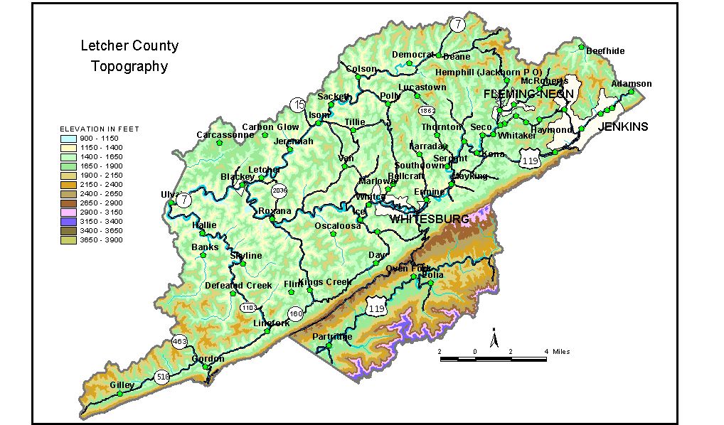
Discussion from McGrain and Currens (1978) Letcher
County is in the mountainous southeastern part of the Eastern Kentucky
coal field, with rugged terrain and great local relief. No county except
Harlan has higher elevations. North of Pine Mountain, the terrain is typical of the dissected Eastern
Kentucky coal field, a region of irregular mountains and valleys with
ridgetop elevations commonly between 2,000 and 2,300 feet. Local relief
of 600 feet or more is found over most of this part of the county. The
highest elevations in Letcher County are found on Black Mountain, a
large, irregular mountain mass lying south of Pine Mountain. The crest
of the mountain approximates part of the boundary between Letcher County,
Kentucky, and Wise County, Virginia. Elevations in excess of 3,500 feet
are common here. The highest elevation in Letcher County, 3,720 feet,
is a peak on Black Mountain at the extreme southeastern corner of the
county. The lowest elevation in the county, approximately 940 feet, is the point where the North Fork of the Kentucky River leaves the western edge of the county. All the communities are located in the valleys. The elevation of Whitesburg, the county seat, is 1,164 feet. Elevations at other communities are Blackey, 1,000 feet; Fleming-Neon, 1,300 feet; Gordon, 1,309 feet; Jenkins, 1,526 feet; Letcher, 1,014 feet; Mayking, 1,214 feet; and Roxana, 1,043 feet. The 7.5-minute topographic quadrangle maps that cover the county are
shown, by name and by index code (Kentucky Natural Resources and Environmental
Protection Cabinet) on the index
map. Previous--Next--Back to "Groundwater Resources in Kentucky"
|
||