| Topography | ||
|
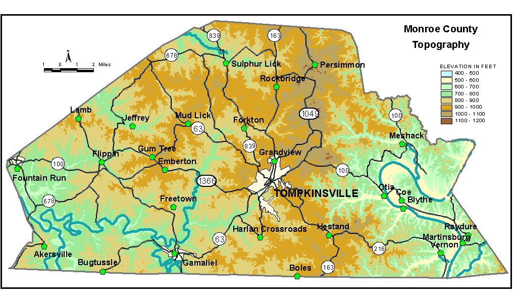
Discussion from McGrain and Currens (1978) Monroe
County is in the Mississippian Plateaus area on the southern border
of Kentucky. The topography varies from highly dissected in the eastern
part to moderately and mildly dissected in the western and central areas
of the county. The most rugged terrain is in the eastern area along
or near the valley of the Cumberland River. The topography here is similar
to that along Muldraugh Hill, and the west side of the valley is topographically
similar to the Muldraugh (Highland Rim) Escarpment. The central and western parts of the county are an upland plateau with
elevations ranging from 1,100 feet on the east to approximately 800
feet on the west. Streams have carved valleys 100 to 150 feet below
the upland, and some of the intervening ridges have nearly flat tops.
Some karst features are present, but do not dominate the landscape.
The highest elevation in the county, 1,141 feet, is near the community
of Persimmon, about 7.5 miles north-northeast of Tompkinsville. An elevation
of 1,130 feet has been recorded for a ridge north of Kentucky 100 about
4 miles east-northeast of Tompkinsville. The elevation of Barren River
at the west boundary of the county is approximately 595 feet. The elevation of Tompkinsville, at the courthouse, is 923 feet. Elevations at other communities are Akersville, 840 feet; Bugtussle, 848 feet; Flippin, 730 feet; Fountain Run, 775 feet; Gamaliel, 850 feet; Mud Lick, 992 feet; Persimmon, 1,090 feet; and Sulphur Lick, 840 feet. The elevation at the entrance of Old Mulkey Meeting House State Park is 910 feet. The 7.5-minute topographic quadrangle maps that cover Monroe County
are shown, by name and by index code (Kentucky Natural Resources and
Environmental Protection Cabinet) on the index
map. Previous--Next--Back to "Groundwater Resources in Kentucky"
|
||