| Topography | ||
|
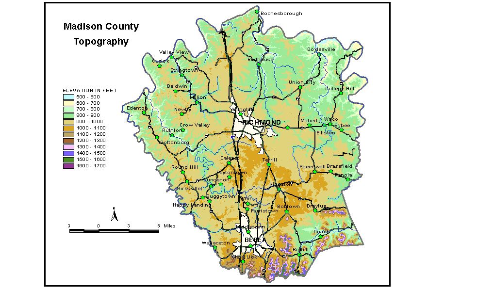
Discussion from McGrain and Currens (1978) Most of Madison
County lies in the Outer Bluegrass Region of central Kentucky, but
the extreme southern area includes the outer edge of the Eastern Kentucky
Coal Field. Various parts of the county are gently rolling, hilly, and
mountainous. The most striking topographic features are the deeply entrenched
valley of the Kentucky River, which marks the northern boundary of the
county, and the Cumberland Escarpment in the southern area. North and northeast of Berea, in the south-central part of the county,
the topography is more subdued. Although the elevations are around 1,000
feet, the relief is the lowest in the county. The principal areas of
flat land in the county are found here. The highest elevations and the greatest local reliefs are found in
the area south of a line between Berea and Panola. The Cumberland Escarpment
and the hills resulting from the erosion of the Eastern Kentucky Coal
Field front are striking topographic features. Peaks and ridges rise
600 to 700 feet or more above the valley floors. Pilot Knob, at 1,411
feet, and Indian Fort Mountain, at 1,552 feet, both near the community
of Bighill, are examples of such erosional remnants. Bear Mountain,
3 miles southeast of Berea, has the highest elevation in Madison County
at 1,660 feet. The elevation of Richmond, at the courthouse, is 950 feet. Other elevations are Berea, 1,034 feet; Bighill, 813 feet; Bybee, 910 feet; Fort Boonesboro State Park, 585 feet; Kingston, 928 feet; Kirksville, 994 feet; Moberly, 877 feet; Panola, 791 feet; Valley View, 568 feet; and Waco, 827 feet. The spillway elevation of Lake Reba is 857 feet, and at Taylor Fork Lake the spillway is at 825 feet. The 7.5-minute topographic quadrangle maps that cover the county are
shown, by name and by index code (Kentucky Natural Resources and Environmental
Protection Cabinet) on the index
map. Previous--Next--Back to "Groundwater Resources in Kentucky"
|
||