| Topography | ||
|
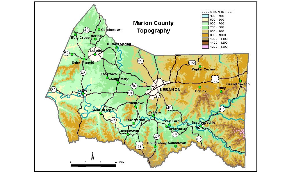
Discussion from McGrain and Currens (1978) Marion
County includes parts of the Outer Bluegrass and Mississippian Plateaus
Regions, the area where the Bluegrass meets The Knobs. The upland masses
that have been separated from the main plateau area by normal stream
erosion are the most striking topographic features of this county. The southern boundary of the county approximates the position of Muldraugh
Hill (Highland Rim). Knobs and irregular upland areas are separated
from the main plateau by North Rolling Fork and Big South Fork. These
hills and knobs rise 400 to 450 feet above the adjacent stream valleys.
For example, the difference in elevation between Lovers Leap and North
Rolling Fork, 3 miles southwest of Gravel Switch, is 400 feet. The highest elevations in the county, on the order of 1,200 feet, are
found principally along the Marion-Casey County line in the southeastern
corner of the county and in the upland area between Big South Fork and
North Rolling Fork on the eastern edge of the county. The highest point
is Putnam Knob, 1,260 feet, about 6 miles east of Lebanon. Rohan Knob,
a prominent landscape feature on the Marion-Nelson County line north
of Holy Cross, has an elevation of 1,090 feet. The lowest elevation, 475 feet, is where Hardin Creek leaves the northern tip of the county. Rolling Fork leaves the county at an elevation of 515 feet. The elevation of Lebanon, the county seat, is 797 feet. Elevations at other communities are Bradfordsville, 682 feet; Gravel Switch, 910 feet; Holy Cross, 698 feet; Loretto, 744 feet; Raywick, 609 feet; Saint Francis, 701 feet; and Saint Mary, 762 feet. The 7.5-minute topographic quadrangle maps that cover Marion County
are shown, by name and by index code (Kentucky Natural Resources and
Environmental Protection Cabinet) on the index
map. Previous--Next--Back to "Groundwater Resources in Kentucky"
|
||