| Topography | ||
|
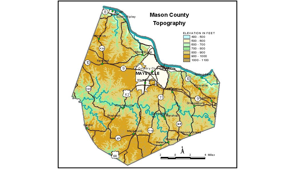
Discussion from McGrain and Currens (1978) Mason
County, in northern Kentucky, is in the Outer Bluegrass Region.
The Ohio River marks the northern boundary of the county and is the
area of lowest elevations. The lowest point, the normal pool level of
the Ohio River, is 485 feet. The valley flats of the Ohio are about
520 to 530 feet. Ridgetop elevations of 900 feet are common throughout the county. The
highest elevation in the county, 1,000 feet, is found on a ridge 1.5
miles west of Mays Lick on the drainage divide between Licking River
and the North Fork of the Licking River. The city hall of Maysville, the county seat, has an elevation of 520 feet. Elevations of other communities are Dover, 520 feet; Germantown, on the Mason-Bracken County line, 960 feet; Helena, 830 feet; Lewisburg, 750 feet; Mays Lick, 898 feet; Minerva, 940 feet; Orangeburg, 761 feet; Sardis, 945 feet; and Washington, 900 feet. The 7.5-minute topographic quadrangle maps that cover Mason County
are shown, by name and by index code (Kentucky Natural Resources and
Environmental Protection Cabinet) on the index
map. Previous--Next--Back to "Groundwater Resources in Kentucky"
|
||