| Topography | ||
|
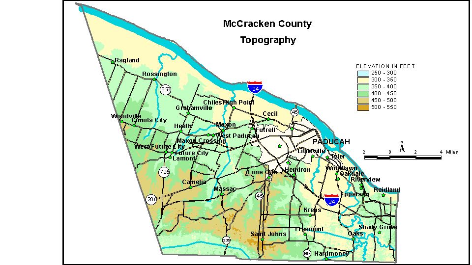
Discussion from McGrain and Currens (1978) McCracken
County is in the northern part of the Mississippi Embayment Region
of western Kentucky. The Ohio River marks the northern boundary of the
county, and the lowest elevations are found here. Normal pool elevation
of the Ohio at Paducah on the upstream side of navigation dam No. 52
is 302 feet; the normal pool elevation below the dam is 290 feet, the
lowest elevation in the county. Highest elevations in the county are found along the Tennessee Valley
divide near St. Johns in the southern part of the county, where ridgetops
have elevations of 500 feet. Other high elevations are present in the
uplands between Mayfield Creek and West Fork of Massac Creek in the
southwestern part of the county, where ridges and knolls attain elevations
of 490 feet, and near the headwaters of Massac Creek, where similar
elevations occur. Greatest local reliefs occur in the vicinity of the
Clarks River and Mayfield Creek, where hills commonly rise 100 feet
or more above the broad valley flats. There are no bluffs on the McCracken
County shore of the Ohio River. The elevation of Paducah, at the courthouse, is 341 feet. Other elevations are Barkley Field, 400 feet; Freemont, 367 feet; Future City, 405 feet; Hardmoney, 350 feet; Heath, 385 feet; Krebs, 363 feet; Lone Oak, 475 feet; Melber, 375 feet; and Reidland, 400 feet. The 7.5-minute topographic quadrangle maps that cover McCracken County
are shown, by name and by index code (Kentucky Natural Resources and
Environmental Protection Cabinet) on the index
map. Previous--Next--Back to "Groundwater Resources in Kentucky"
|
||