| Topography | ||
|
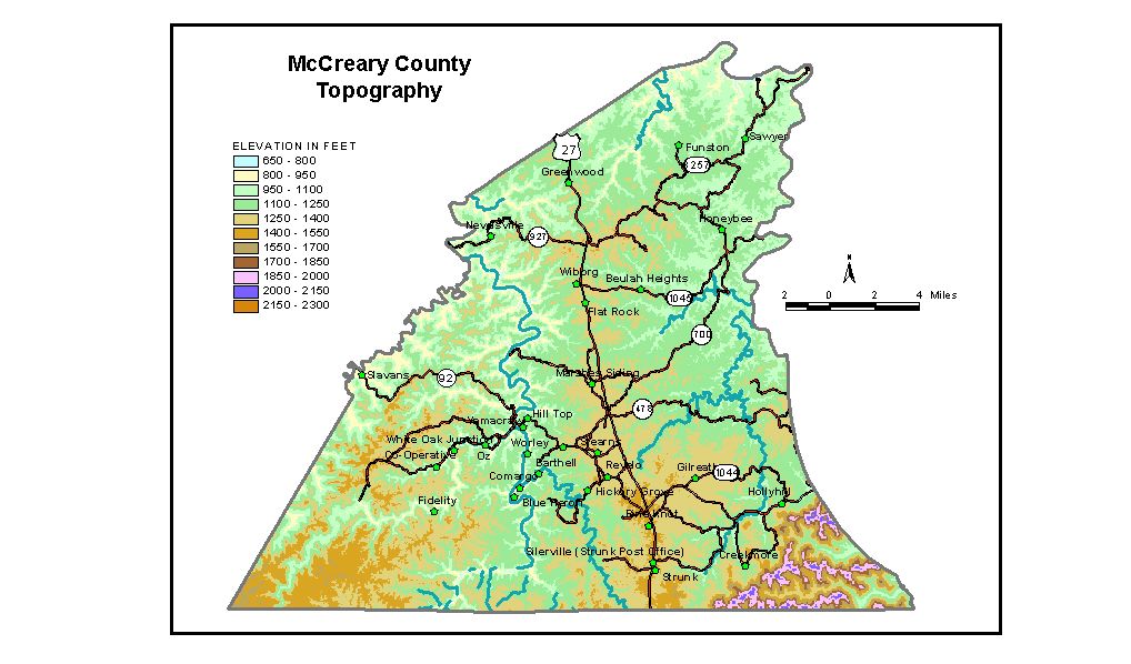
Discussion from McGrain and Currens (1978) McCreary
County is at the southwestern tip of the Eastern Kentucky Coal Field.
It is a well-dissected upland with a hilly to mountainous terrain. Cliff-lined
gorges and ridges are present throughout much of the area. Resistant
rock formations have produced such scenic features as chimney rocks,
natural arches, precipitous cliffs, and waterfalls. Only an occasional
flat-topped ridge or a valley flat interrupt the general rugged appearance
of the topography. The Cumberland River, which marks the northeastern county boundary,
and South Fork of the Cumberland River, which crosses the western part
of the county, have carved valleys 400 to 500 feet below the adjacent
uplands. Flowing through a narrow cliff-lined gorge over shoals, rapids,
and falls, the Cumberland River drops more than 140 feet from the point
where it enters the county on the east to Lake Cumberland. Cumberland
Falls is the most spectacular drop along this part of the river, and,
because of the volume of water flowing over it, it is the most spectacular
waterfall in Kentucky. The lowest elevation in the county is 723 feet,
the normal pool level of Lake Cumberland. The elevation of Whitley City, the county seat, is 1,360 feet. Other elevations are Bell Farm, 980 feet; Beulah Heights, 1,300 feet; Flat Rock, 1,300 feet; Greenwood, 1,218 feet; Hollyhill, 1,178 feet; Parkers Lake, 1,260 feet; Pine Knot, 1,420 feet; Silerville, 1,426 feet; and Stearns, 1,351 feet. The 7.5-minute topographic quadrangle maps that cover McCreary County
are shown, by name and by index code (Kentucky Natural Resources and
Environmental Protection Cabinet) on the index
map. Previous--Next--Back to "Groundwater Resources in Kentucky"
|
||