| Topography | ||
|
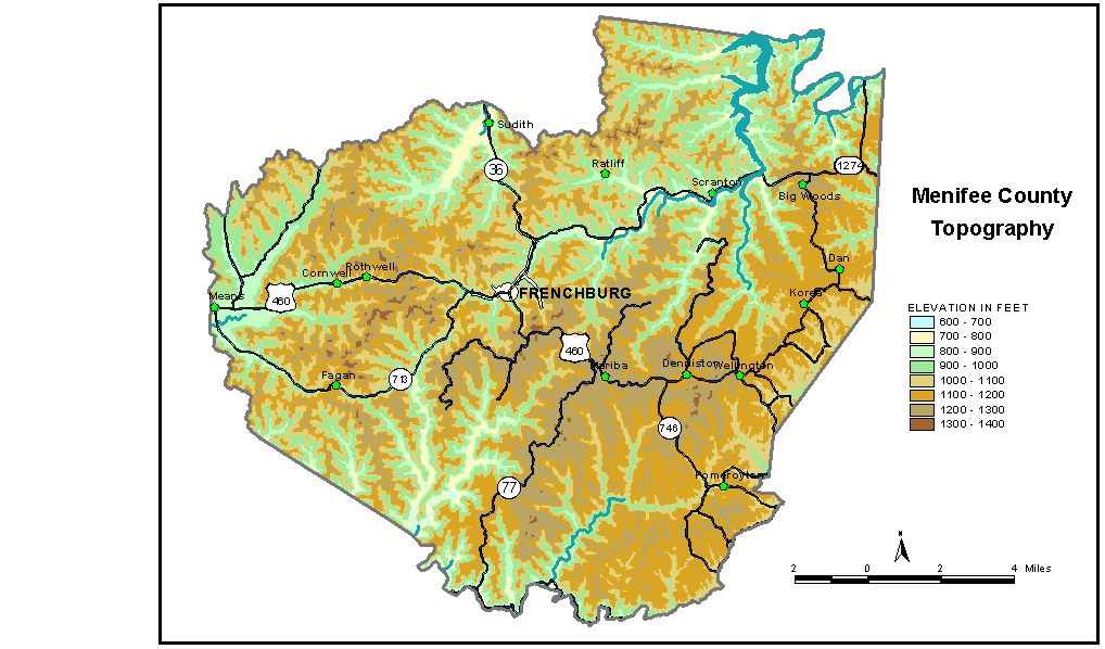
Discussion from McGrain and Currens (1978) Menifee
County is at the western edge of the Eastern Kentucky Coal Field.
It is an upland area well dissected by normal stream drainage. The terrain
in the northern and western parts of the county is characterized by
cliff-lined ridges. In the southeastern part of the county, cliffs are
found in the bottoms or midpoints of the valley walls at lower elevations. Valleys are cut 100 to 500 feet below the uplands. The picturesque
valley of Red River, which marks part of the southern boundary of the
county, is 200 to 500 feet deep. The upper part of the valley wall is
rimmed with nearly vertical cliffs. The elevation of Red River, where
it leaves the county, is approximately 670 feet, the lowest point in
the county. Cave Run Lake, a flood-control facility, impounds waters of Licking River. Normal pool level is 730 feet, and the maximum flood pool (spillway elevation) is 765 feet. The elevation of Frenchburg, the county seat, is 870 feet. Elevations at other communities are Denniston, 1,105 feet; Fagan, 1,192 feet; Means, 850 feet; Pomeroyton, 1,050 feet; Scranton, 734 feet; and Sudith, 750 feet. The 7.5-minute topographic quadrangle maps that cover Menifee County
are shown, by name and by index code (Kentucky Natural Resources and
Environmental Protection Cabinet) on the index
map. Previous--Next--Back to "Groundwater Resources in Kentucky"
|
||